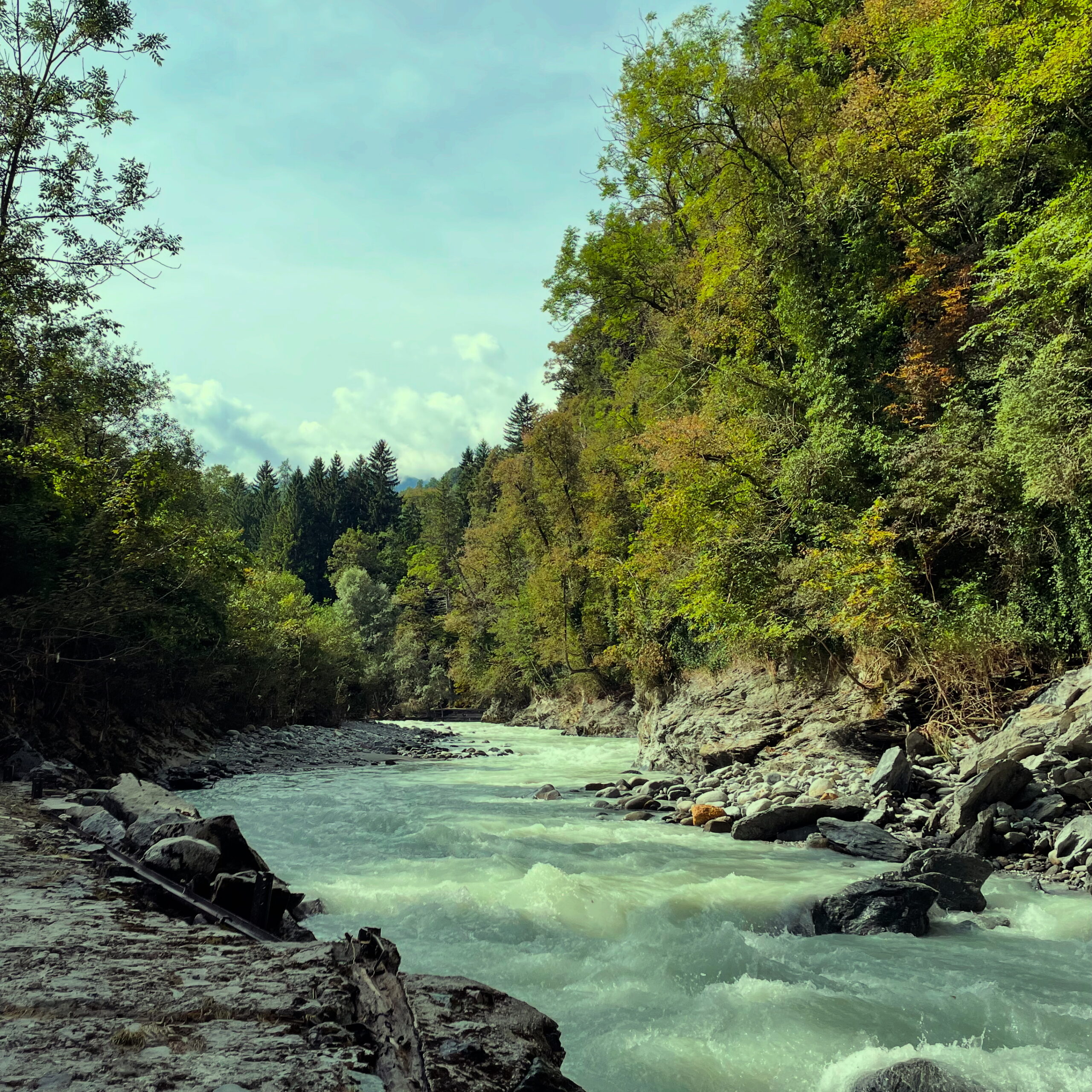
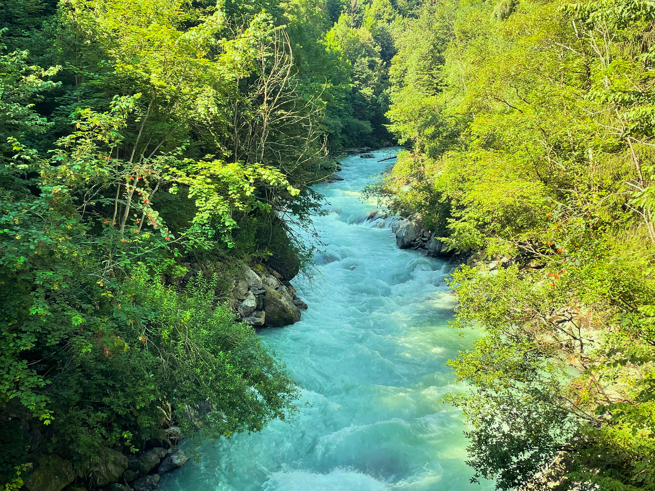
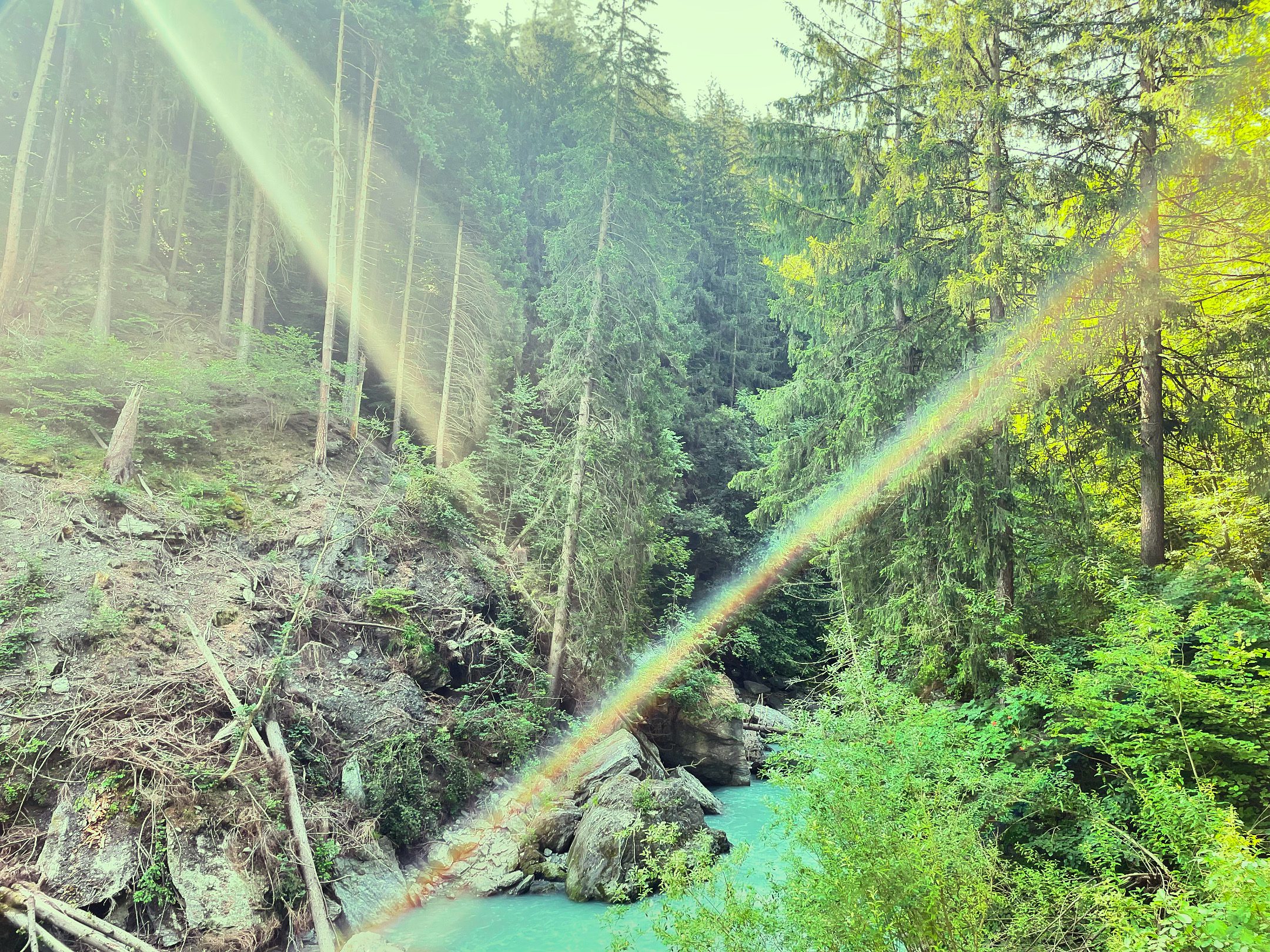
Sill Gorge
Worth knowing
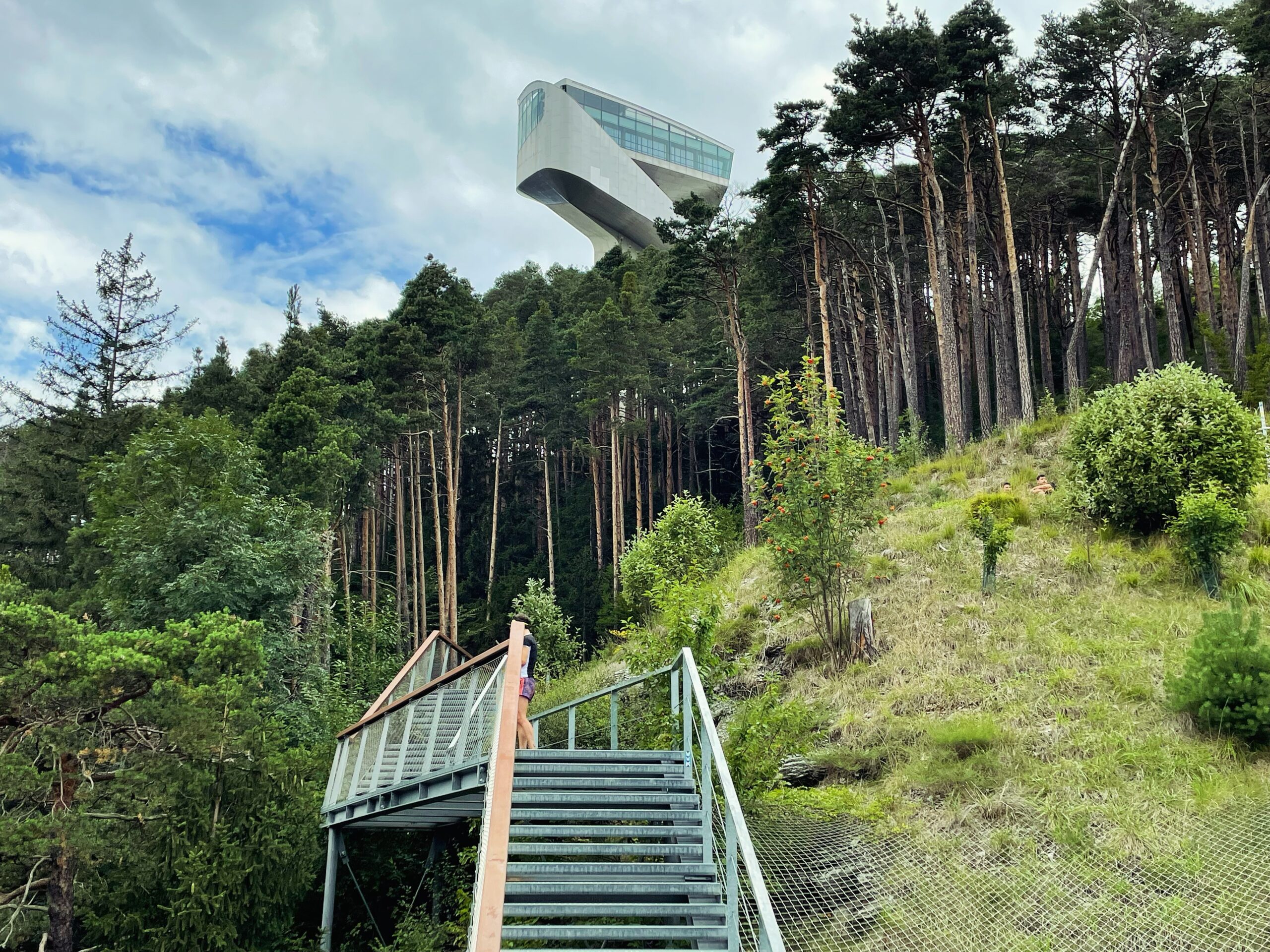
A little above the Brenner Pass, at an altitude of 2,300 meters, the Vennebach rises. After a brief stopover beside the motorway in Lake Brenner, its ice-cold waters—now under the more familiar name Sill—flow toward Innsbruck. Along the way, several tributaries from alpine side valleys feed the Sill, allowing it to swell to a respectable size. Between Gärberbach and Wilten Abbey, it has carved a spectacular landscape feature over the course of millennia: the Sill Gorge. The narrow ravine, wedged between the city, the Brenner railway line, the federal highway, and the motorway, has a very distinctive atmosphere. Hardly a ray of sunlight makes it past the trees and rock faces. From early on, the mystical landscape was shrouded in an aura of the uncanny and became the source of numerous urban legends. The earliest of these is the dragon of the Haymon legend, which is said to have had its lair in the Sill Gorge and to have terrorized the inhabitants of Wilten with its destructive fury as early as late antiquity. In the 19th century, the Innsbrucker Nachrichten regularly reported terrifying incidents from this stretch of wilderness close to the city. Robbers and murderers were said to hide from the authorities in the Sill Gorge. To criminals, troublemakers, and petty crooks were added missing persons, bodies recovered from the water, injured timber workers, hikers who had suffered accidents, suicides, and socialist “agitators.” The most gruesome crimes, however, were neither mysterious nor accidental, but carried out deliberately and by official order: during the National Socialist era, deserters were executed in the Sill Gorge. In more recent times, homeless people settled here on the fringes of the city, while young people gathered for parties and raves without official permission.
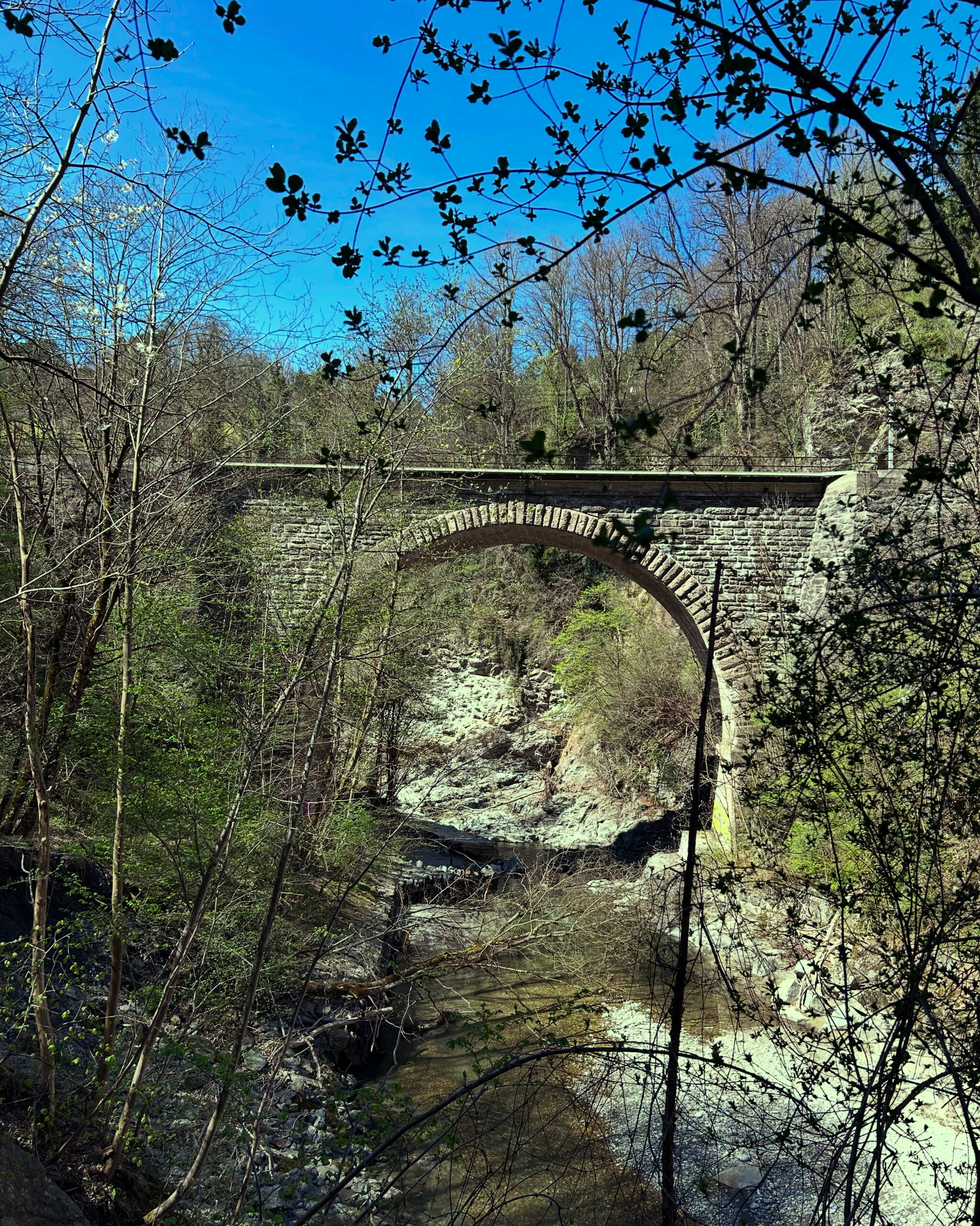
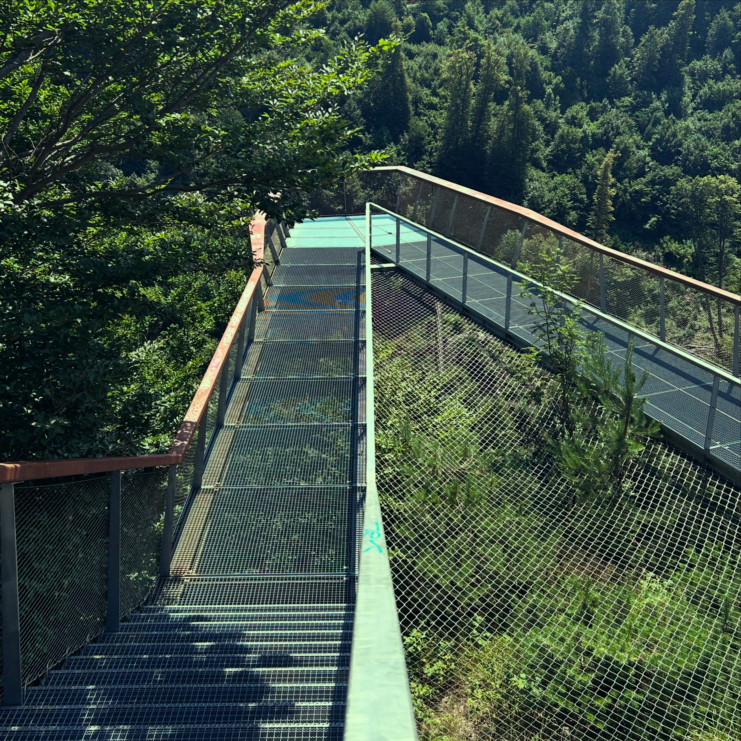
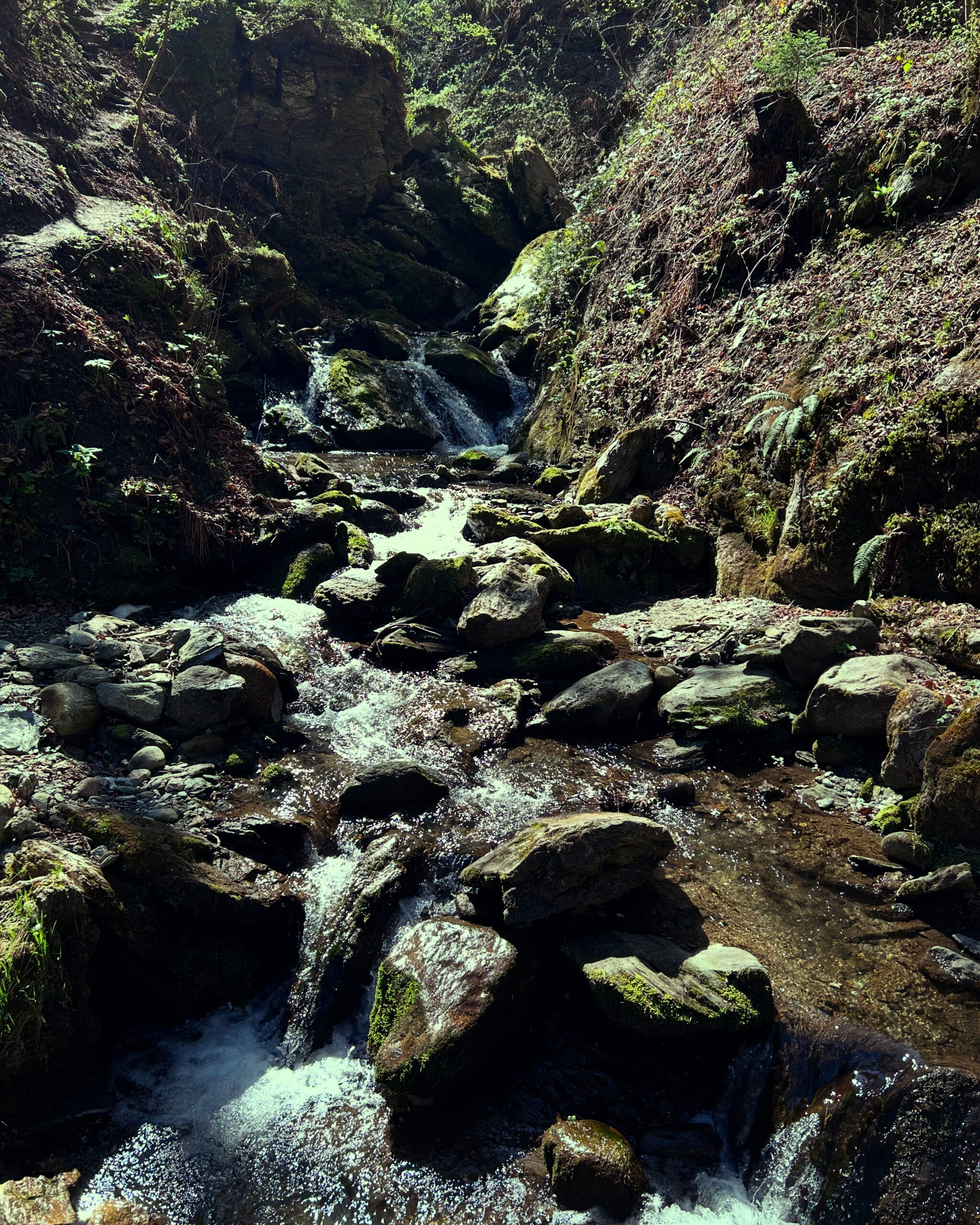
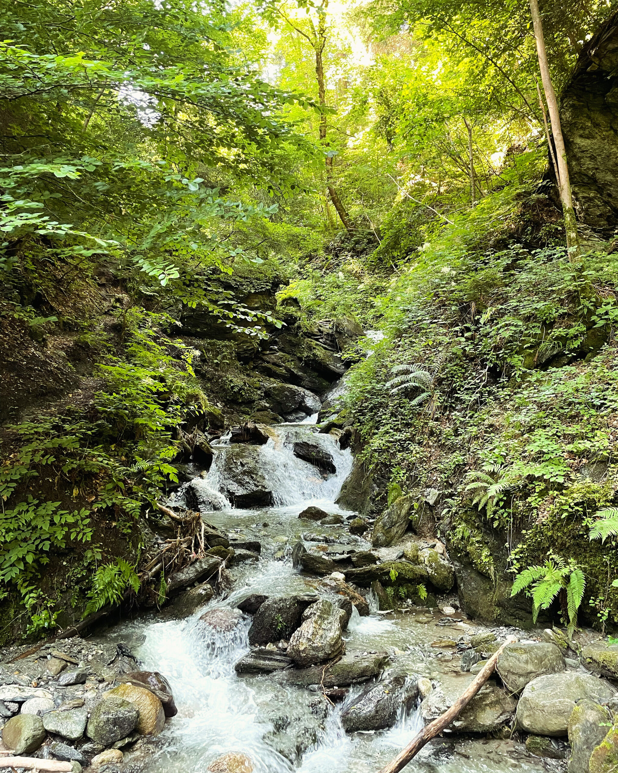
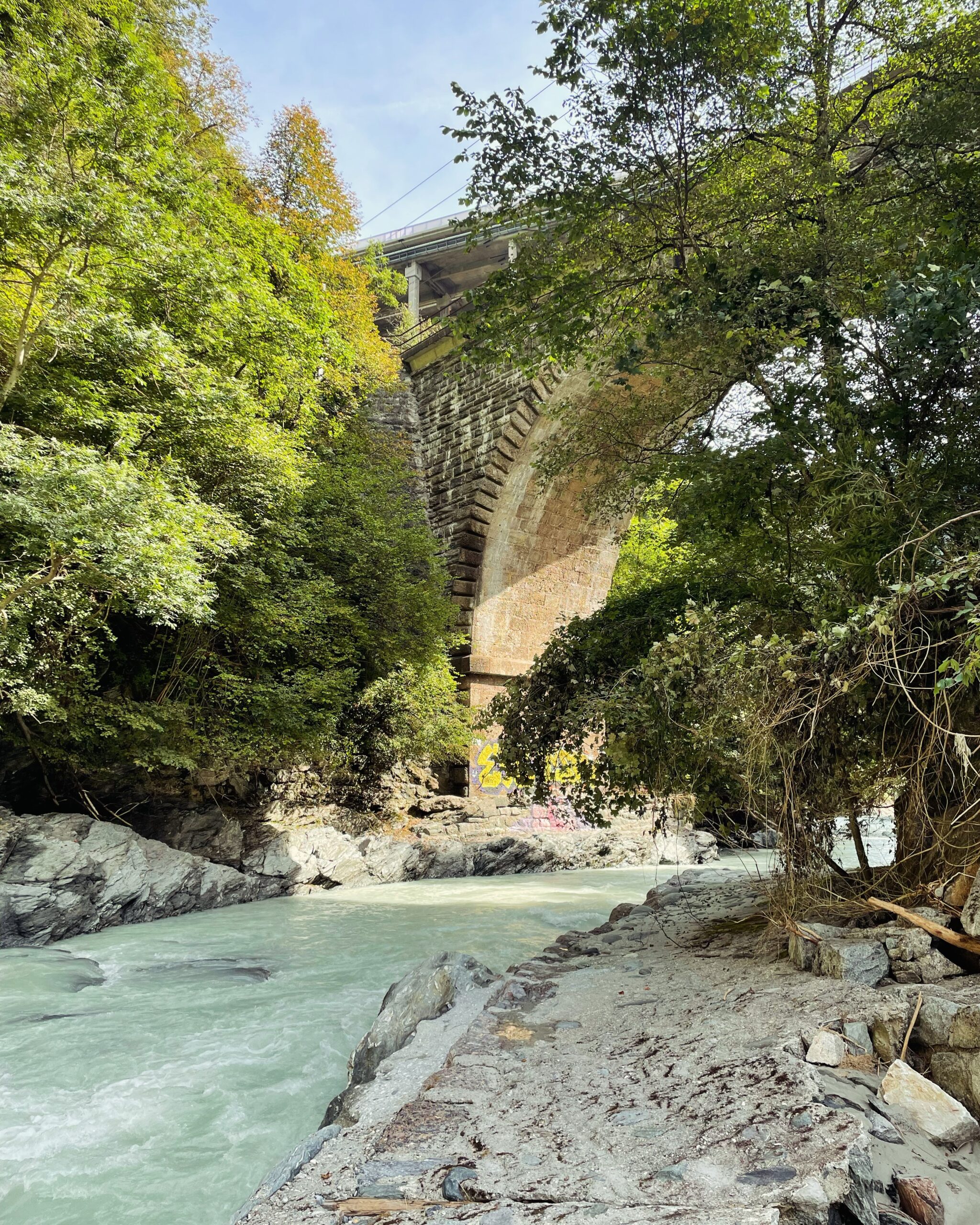
Despite—or perhaps precisely because of—its eerie reputation, the Sill Gorge is above all one thing: Innsbruck’s most beautiful recreational area close to the city. In summer, it offers shady bathing spots for those fleeing the heat, while in winter one can admire massive icicles dangling from the rock faces. The gentle sunlight of autumn lends the leaves of the mixed forest especially vivid colors. Along the banks of the river—at times flowing calmly, at others thundering wildly—visitors can marvel at bizarre rock formations, ivy, and small waterfalls. As early as 1907, the idea arose to make the difficult-to-access gorge accessible to walkers. Owing to the rugged terrain and the Sill Gorge’s poor reputation, it took twenty-five years before the Sill Gorge Trail could be handed over to the city by the Innsbruck Beautification Association. Entry into the gorge is possible at several points. From the Gasthaus Bretterkeller, a path leads past the construction site of the Brenner Base Tunnel to the beginning of the riverside walking trail. Those arriving by car can park at Bergisel and descend directly from there. Slightly farther south, a path from the Sonnenburger Hof leads into the central section of the gorge. Visitors who wish to start the walk from the southern end can reach Gärberbach by bus or car. Bridges and footbridges repeatedly cross the river, offering beautiful views of the impressive, wild-romantic landscape. In the middle of the Sill Gorge, the Bergisel Panorama Trail branches off and leads to the Dragon Rock, with its spectacular viewing platform. In the southern section, the path narrows into a trail that requires some sure-footedness and appropriate footwear, but remains manageable even for families with children. After heavy rainfall and thunderstorms, sections are occasionally closed due to landslides. Shortly before Gärberbach, the path passes gardens with small weekend cottages before reaching the spectacular viaduct at the end of the Sill Gorge. On one of the massive pillars beneath the bridge, a bronze plaque commemorates the seemingly endless restoration of the Panorama Trail as a recreational destination. A memorial stone near one of the green benches of the Beautification Association at the northern end of the gorge, known as Schober Ruh, is dedicated to the chairman of the Innsbruck Beautification Association under whose leadership the wild ravine was tamed and the path opened to walkers.
Thyrsus, Haymon and the Bavarians
After the disappearance of the Western Roman Empire and its associated administrative structures, Germanic tribes took control of the territory of what is now Innsbruck. In North Tyrol, between the rule of the Imperium Romanum and that of Emperor Charles (748–814)—that is, during the period known as the Migration Period, Late Antiquity, or the Early Middle Ages—a whole range of different peoples were active. Alongside the Romanised Breones, Goths, Lombards, Bavarians (Bajuwarians), Suebi, and Slavs settled in the regions north of the Brenner Pass, living alongside, behind, and intermingled with one another. In the central Inn Valley, the Bavarians were able to establish themselves as the dominant regional power. Although the Roman fort of Veldidena was destroyed during the process of settlement, the transition for the Breonic‑Romanised population was probably less sudden and violent than gradual and fluid. The Bavarians were not barbaric destroyers; rather, they had been in contact with the Roman world for centuries in one form or another. Armed conflict was likely the exception. Over time, the cultures merged during a period in which political authority was relatively loose in nature. The everyday spoken language was a form of Germanic, while Latin had already established itself early on as the written language. The most important legacy of Rome—and soon a unifying element—was Christianity. From the 8th century onward, the Bavarians were Christianised. Under Emperor Charles, the “barbarian” Bavarians became Christian dukes of Bavaria, and with them the Inn Valley became part of the Holy Roman Empire, which extended over large parts of Central Europe and northern Italy. In administration, they relied on the church structures inherited from the Romans, as clerics were often the only literate members of society. Instead of the regional magistrates of the Roman emperors, an armoured aristocracy now ruled as feudal lords of the Frankish king Charles, anointed by the Pope, governing in God’s name over subjects who continued—largely undisturbed—to toil in agriculture. The Christian Church Father Paul had laid the theological foundation for this system in his Letter to the Romans:
Let everyone be subject to the governing authorities, for there is no authority except that which God has established. The authorities that exist have been established by God. Consequently, whoever rebels against authority is rebelling against what God has instituted, and those who do so will bring judgment on themselves. For rulers hold no terror for those who do right, but for those who do wrong. Do you want to be free from fear of the authority? Then do what is right and you will be commended. For the one in authority is God’s servant for your good. But if you do wrong, be afraid, for rulers do not bear the sword for no reason. They are God’s servants, agents of wrath to bring punishment on the wrongdoer. Therefore, it is necessary to submit to the authorities, not only because of possible punishment but also as a matter of conscience. This is also why you pay taxes, for the authorities are God’s servants, who give their full time to governing.
Culturally, Christianity in the Alpine region proved adaptable to existing traditions and customs. Christian martyrs and saints replaced pagan polytheism. Ancient festivals such as the winter solstice, harvest celebrations, or the beginning of spring were integrated into the Christian calendar and replaced by Christmas, All Saints’ Day, and Easter. Popular legends surrounding miraculous plants, ominous mountain peaks, magical beings such as the Salige Fräulein, enchanted kings, and other mythical figures could continue to be revered alongside Christianity without difficulty.
Two of the most popular legendary figures in Innsbruck to this day play the central roles in the foundation myth of Wilten Abbey. An extraordinarily strong knight, known as the giant Haymon, travelled to Tyrol at some point between Late Antiquity and the Early Middle Ages. There he encountered the long‑established giant Thyrsus of Seefeld. While the Germanic Haymon was equipped in modern fashion with sword and shield, Thyrsus—who bore a Romanised name but is portrayed in legend as a wild Alpine inhabitant—had only a tree trunk as his weapon. As fate would have it, the sword struck down the wooden club, and Thyrsus lay slain on the ground in his own blood. Filled with remorse over his deed, Haymon converted to Christianity and was baptised by the Bishop of Chur. Instead of constructing a military fortress as originally planned, the repentant warrior built a monastery on the ruins of the Roman fort of Veldidena. Despite his newfound piety, his time of heroic deeds was not yet over. In the nearby Sill Gorge there dwelled a fearsome dragon that not only devastated the new construction every night but also made meaningful settlement of the region impossible. Haymon slew the monster, cut out its tongue, and bequeathed it to his own foundation. After his career as a dragon slayer, Haymon handed the monastery over to the Benedictine monks from Tegernsee and himself entered the order as a lay brother. The people of the region were so grateful to the giant for liberating them from the dragon that they willingly placed themselves under the tithe‑paying protection of Wilten Abbey, cultivating the formerly wild land as farmers. And the moral of the story? Haymon represents the initially violent but later noble and benevolent Germanic settlers; Thyrsus stands for the brave and wild, yet ultimately defeated inhabitants of the region between the Seefeld Plateau and the Brenner Pass. The dragon symbolises the evil, destructive, and unchristian paganism that is eradicated by the converted German. The monastery brothers—richly endowed by the valiant knight—are the organising force without which nothing would function. Over the centuries, the Haymon legend and its moral proved just as flexible as Christianity itself during its introduction in Late Antiquity. At times, Haymon was portrayed as a nobleman from the Rhine who came to Tyrol after the death of Charlemagne; at other times, he appeared as a follower of the Ostrogothic king Theoderic—better known as Dietrich of Bern—travelling between Ravenna and Germany. From the Middle Ages until the 19th century, the focus lay on Haymon’s conversion, the protection of the peasant subjects by Christian knighthood, and the foundation of the monastery, all serving to legitimise the benevolent feudal system. In an article in the Innsbrucker Nachrichten of 2 October, however, the author Dr Franz Wöß almost entirely set aside the Catholic aspect of the monastery’s construction and instead emphasised the heroic German element, before turning to the healing properties of Thyrsus oil, which the farmers of Seefeld had extracted from oil‑bearing shale stones since the Middle Ages. In this version of the legend, after his heroic deeds Haymon withdrew into the wilderness of Seefeld as a hermit rather than ending his life as a cleric at Wilten Abbey. After the Second World War, there was once again a desire to distance oneself as much as possible from Germanic identity. The mural created in 1956 on the façade of the “Gasthaus zum Riesen Haymon” depicts the defeated Thyrsus, bearing the Austrian coat of arms—entirely in keeping with the post‑war victim narrative.
The power of geography
What most visitors to Innsbruck notice first are the mountains, which seem to encircle the city. The mountain landscape is not only beautiful to behold, but has always influenced many aspects of life in the city. This begins with seemingly minor things such as the weather, as the perspective of the theologian, writer, and politician Beda Weber from earlier times demonstrates:
"“A phenomenon of its own is the warm wind, or Scirocco. It comes from the south, strikes the northern mountains, and then plunges violently into the valley. It often causes headaches, but quickly melts the winter snow masses and greatly promotes fertility. This makes the cultivation of maize possible in Innsbruck.”"
This weather phenomenon may have changed its name from Scirocco to Föhn, and traffic was not yet a major problem in 1851. Yet just as Innsbruck’s motorists complain today, the horseshoer in the old town in 1450 and the legionary dispatched from central Italy to the Alps in the year 350 certainly lamented the warm downslope wind that seems to drive everyone mad several times a month. While people in the past were grateful for the warm air that melted snow on the fields, today tourism officials complain about snow-free ski slopes on the Seegrube.
The location between the Wipptal Valley in the south and the Nordkette range influences not only the frequency of migraines, but also the leisure activities of Innsbruck’s residents, as Weber also observed. “The inhabitants are distinguished by their sociability and benevolence; they particularly enjoy excursions into the countryside during the fine season.” One may debate the sociability and benevolence of Innsbruck’s residents, but countryside outings in the form of hiking, ski touring, or cycling remain very popular today. No wonder—Innsbruck is surrounded by mountains. Within minutes, one can be standing in the middle of a forest from almost anywhere in the city. Young people from across Europe spend at least part of their studies at the University of Innsbruck, not only because of its excellent professors and facilities, but also to enjoy their free time on ski slopes, mountain bike trails, and hiking paths without having to forgo urban flair. This is both a blessing and a curse. The university, as a major employer and educational institution, boosts the economy, while at the same time the influx of students from elsewhere drives up the cost of living in a city that, hemmed in by mountains, cannot expand further.
What today may be perceived as a limitation to spatial growth was once a reason for growth. Innsbruck was fortunate to have access to fresh drinking water thanks to the nearby mountains. In the 15th century, the Nordkette was tapped to supply the city with drinking water. In 1485, the city council had a pipeline laid from a spring in Gramart, near today’s Katzenbründlweg east of Hungerburg, into the city. Using larch-wood pipes up to four meters long, clean water was conducted down into the valley floor. At the Inn Bridge, the pipeline branched left and right toward Mariahilf and St. Nikolaus, and across the Inn into the old town and the Neustadt. Until this small technical masterpiece was constructed, Innsbruck—like other cities—had relied on groundwater from wells. This water was often stagnant and full of pathogens. Beer and wine were not considered safer everyday beverages than water without reason. While the plague could not be kept at bay permanently, typhus and cholera were less widespread than in other cities. Not only because of its drinking water did Innsbruck rise in the 15th century from a small trading outpost to the residence city of the Tyrolean sovereigns. The Brenner Pass is very low and allows the Alpine belt winding along Italy’s northern border to be crossed relatively easily. In times before railways transported goods and people effortlessly from A to B, crossing the Alps was hard labor, and the Brenner was a welcome relief. Between 1239 and 1303, Innsbruck was the only city between “Mellach and Ziller” in the central Inn Valley to hold the princely staple right. Within the regulated carting system, goods had to be transferred from one wagon to another here—an enormous advantage for Innsbruck’s economy. Innsbruck was not as wealthy as Bolzano and had no political significance until the early 15th century, but it became one of the most important transport and trading hubs in the Alpine region. The former provincial capital Merano had no long-term chance against the city on the Inn between the Brenner, Scharnitz, and Achen passes due to its isolation. The Alpine location also favored tourism, which gained a foothold by the 1860s at the latest. Travelers appreciated the combination of easy accessibility, urban infrastructure, and alpine flair. With the opening up of the mountainous region by rail, visitors could travel comfortably, spend their leisure time in the mountains or in one of the spa resorts, and still enjoy the comforts of city life. Once tamed by the rails, the Alps had transformed from a source of problems into an economic asset. The era shaped by difficult agricultural conditions was over; yesterday’s enemy had become a savior.
Alongside the mountains, rivers and springs played a crucial role in Innsbruck’s development. Although the city’s drinking water came from the Nordkette via a pipeline, the Inn and the Sill were responsible for sanitation. Livestock were led to the Inn to drink, laundry was washed there, and all kinds of waste—including human and animal excrement—were disposed of in the river. As the city began to grow during industrialization, a first landfill was created at the Sillspitz in the east of the city, later supplemented by another in the west at today’s Sieglanger. More than a thousand years after Roman settlement, the Inn Valley was still a marshy landscape crisscrossed by riparian forests. Settlements such as Wilten, castles like the fortress above Amras, and roads were built some distance from the river on alluvial fans or at mid-altitude elevations. Around Innsbruck, the floodplains were used as communal land by the villages. Depending on the water level, pastureland and firewood were available, and the river could—or could not—be used as a transport route. Field names such as Am Gießen in the Hötting floodplain still recall the fact that the Inn, within today’s city limits, remained an untamed and only poorly cultivated wilderness until the early modern period. Flooding was a recurring consequence of the unregulated river. Between 1749 and 1789, several floods in Innsbruck claimed many lives, and the economic damage was immense. The Inn Bridge brought customs revenues into the city treasury and was the reason the settlement could develop into a city.
Until the road network was improved in the 16th century, heavy river traffic prevailed between Telfs, Innsbruck, and Hall. The rafts used to transport goods were flat platforms measuring up to 35 by 10 meters. Several of these vessels formed a convoy that carried all kinds of goods down the Inn to its confluence with the Danube in Passau and onward to the east. Silver, building materials, timber, salt, wheat, meat—the upstream-bound convoys, hauled by horses along towpaths beside the riverbed, were the fastest way to transport large quantities of goods through the Inn Valley. The military also used the Inn for logistical support. For centuries, timber from the Upper Tyrol was floated downstream as log drives. In Hall, a timber rake at the Inn Bridge caught the valuable driftwood. Innsbruck, and especially the salt and silver mines in Hall and Schwaz, depended on this material and energy source. Near settlements and cities, fortified river engineering structures were built to tame the river at least somewhat and reduce the effects of flooding and drought. In the 18th century, the economization and scientification that affected all areas of life also promoted the cultivation of the landscape. Inspired by the spirit of the Enlightenment, efforts were undertaken to optimize the Inn as a transport route and increase the productivity of available land. The communal lands along the Inn were increasingly placed under the stewardship of individual landowners who advanced the reclamation of this alluvial terrain. The Theresian state apparatus sought to connect the vast Habsburg Empire not only by roads, but also via its major rivers. Responsibility for regulating and engineering the Inn shifted from the municipalities and the Hall saltworks to the state. Innsbruck’s first chief river engineer, Franz Anton Rangger, began mapping the Inn in 1739 in order to make the river course more predictable and faster through straightening and construction works. The project of taming the river would take more than 100 years. The Napoleonic Wars delayed construction, and only after the economic hardship of the early 19th century was the state able to continue the project. Stone block dikes gradually replaced the earlier wooden structures. By the time the Inn was finally tamed, railways had replaced river shipping as the main transport route. The next major phase of river engineering came in the second half of the 20th century. The Olympic Village, the motorway, and settlements such as Sieglanger required space that had previously been reserved for the river in order to enable the postwar economic miracle.
Almost as important as the Inn was the smaller river that runs through Innsbruck. Where the Sill emerges from the Sill Gorge today, the Sill Canal originated, supplying the city with water. When the Counts of Andechs founded their market at the Inn Bridge in 1180, the canal already existed, as the mill of Wilten Abbey in St. Bartlmä was already in operation. From there, it ran along what are now Karmelitergasse, Adamgasse, Salurnerstraße, Meinhardstraße, Sillgasse, and Ingenieur-Etzel-Straße to the Pradl Bridge, where it rejoined the Sill before flowing into the Inn. During construction work, sections of this walled channel are repeatedly uncovered. Initially intended primarily for fire protection, many businesses soon made use of the water flowing through this artificial canal for energy generation. The last remnants disappeared in the 1970s after bomb damage during the Second World War.
Innsbruck’s residents were blessed not only with drinking water, the Inn as a transport route, and the energy-providing Sill Canal—many springs were also said to have healing properties. As early as the Middle Ages, water from the Nordkette was used to treat various ailments. The oldest bathhouse was the Ofenloch Bath, also known as the Weinstock Bath, in the old town, where since the 13th century Innsbruck residents could relieve themselves of numerous complaints under the expert hands of the bath attendant, thanks to the miracle water of the Weinstock Spring in Hötting. The Kaiserkronen Bath in Innsbruck’s Badgasse was based on this institution and used water from this spring until it closed in the 20th century. Bad Egerdach near Innsbruck has been documented as a healing spring since 1620. The spring was said to cure gout, skin diseases, anemia, and even the nervous disorder known in the 19th century as neurasthenia, considered a precursor to burnout. The bathhouse chapel still exists today opposite the SOS Children’s Village. In the 18th century, a bathhouse for wounded soldiers existed in the hospital next to the Mariahilf Church, supplied with water from the Hötting Cherry Valley. The Neckelbrünnl in Mühlau was also a well-known healing spring. At the Kratzerbrünnl on Brennerstraße, halfway between Innsbruck and the Stefansbrücke, people followed the popular 19th-century drinking cure to detoxify the body. Innsbruck’s rise as a stronghold of early alpine tourism is also due to these healing springs, which enabled an early form of wellness.
The final geographical ingredient in the city’s success story is the broad valley basin that favored Innsbruck’s development. As the city grew and its population increased, so did the demand for food. While farmers in the higher side valleys faced harsh conditions, the Inn Valley offered fertile soil and ample space for livestock farming and agriculture. Until the High Middle Ages, the Inn Valley was far more heavily forested. In the 13th century, as in many parts of Europe, the area around Innsbruck experienced early large-scale and long-term human interventions in nature for economic purposes. Contrary to common portrayals, the Middle Ages were not a primitive period of stagnation. From the 12th century onward, people no longer relied solely on prayers and divine grace to escape the effects of recurring crop failures. Innovations such as the three-field system made it possible to feed the agriculturally unproductive urban population—what would be called “overhead” in modern terms. The reclamation of the surrounding countryside allowed the city to grow. On the slopes of the Nordkette, Innsbruck even had its own vineyards until the early 16th century, albeit with modest yields. Cities such as Schwaz, Hall, and Innsbruck could not feed themselves, and especially during the early modern mining boom, substantial food imports were necessary—meat and wine in particular came from neighboring regions. Without the surrounding farmers, however, Innsbruck would not have been viable. The maize that Beda Weber already found noteworthy in Innsbruck’s cityscape in 1851 is still growing vigorously today and continues to give large areas on the city’s outskirts an agricultural character.
Tourism: From Alpine summer retreat to Piefke Saga
In the 1990s, an Austrian television series caused a scandal. Die Piefke Saga, written by the Tyrolean author Felix Mitterer, portrayed in four darkly humorous and revealing episodes the relationship between the German tourist family Sattmann and their hosts in a fictional Tyrolean holiday resort. Despite all justified criticism of modern tourism and its sometimes extreme excesses, one should not forget that tourism in the nineteenth century was an important driving force for the development of Innsbruck and its surroundings—not only economically. The first travellers to visit Innsbruck were pilgrims and “business people” of the early modern period. Merchants, journeymen on their travels, officials, soldiers, entourages of visiting nobility, skilled labourers, miners, clergy, pilgrims, and scholars were the earliest “tourists” attracted to the city between Italy and the German lands. Travel was expensive, dangerous, and arduous. Moreover, many subjects were not permitted to leave their place of origin without the consent of their feudal lord or abbot. Those who travelled usually did so on foot. Although Innsbruck’s inns and taverns profited from travellers as early as the Middle Ages and the early modern period, tourism in the modern sense did not yet exist. This began only when a few eccentrics were first drawn to mountain peaks. For this to happen, not only was a growing middle class required, but also a new perception of the Alps. For a long time, mountains had been regarded purely as a threat. It was primarily the British who, having explored the world’s oceans, now sought to conquer its mountain ranges as well. From the late eighteenth century onward, during the Romantic period, travel accounts began to spread the idea of the natural beauty of the Alps. The first foreign-language travel guide to Tyrol, Travels through the Rhaetian Alps by Jean François Beaumont, appeared in 1796. In addition to the alpine scenery, it was also the “wild and exotic natives” of Tyrol that fascinated international audiences. The bearded rebel Andreas Hofer, who had managed to challenge Napoleon’s army with a peasant force, attracted as much attention in Britain—the traditional enemy of France—as among German nationalists north of the Alps, who saw in him a kind of proto-German figure. Tyroleans were perceived as a stubborn, archetypal, and untamed people, comparable to the Germanic tribes under Arminius who had once resisted the Roman Empire. Descriptions of Innsbruck by authors such as Beda Weber (1798–1858), along with other travel accounts in the rapidly expanding press landscape, helped shape an attractive image of the city.
The next step was to make the wild Alpine environment accessible to a growing number of tourists who wished to emulate early adventurers, even if their willingness to take risks and their physical fitness fell short. In 1869, the German Alpine Club established a section in Innsbruck, following the relatively unsuccessful founding of the Austrian Alpine Club in 1862. Driven by the Greater German idea shared by many members, the two associations merged in 1873. To this day, the Alpine Club retains a largely bourgeois character, while its social-democratic counterpart is the organisation Naturfreunde. The network of hiking trails expanded, as did the number of mountain huts capable of hosting guests. As a transit region, Tyrol already possessed numerous mule tracks and footpaths that had existed for centuries and now formed the basis for alpine tourism. Small inns, farms, and stations along postal routes served as accommodation. Key figures such as the Tyrolean theologian Franz Senn (1831–1884) and Adolf Pichler (1819–1900) were instrumental in surveying Tyrol and creating maps. Contrary to popular belief, the Tyroleans were not born mountaineers but had to learn how to master the alpine environment; previously, mountains had been viewed mainly as dangerous obstacles in agricultural life. The Alpine clubs also trained mountain guides. Around the turn of the century, skiing began to gain popularity alongside hiking and mountaineering. Ski lifts did not yet exist; to climb mountains, skins were attached to skis—a practice still used in ski touring today. Only from the 1920s onward, with the construction of cable cars to the Nordkette and Patscherkofel, did a wealthier clientele begin to enjoy the modern luxury of mechanised mountain access.
This development required new hotels, cafés, inns, shops, and modes of transport to meet the needs of visitors. Guests accustomed to running water and telephones in cities like London or Paris were not willing to accept basic conditions such as outdoor toilets. Inns of the first and second class were suitable for transit travellers but not equipped for more discerning tourists. Until the nineteenth century, innkeepers in Innsbruck and the surrounding villages belonged to the upper middle class in terms of income, but their profession was not considered particularly prestigious. Many were farmers who supplemented their income by serving food and drink. As local meeting points and hubs in postal and goods networks, inns were centres of information, yet innkeeping did not carry the status of a guild profession or bourgeois occupation. This changed with the professionalisation of tourism. Entrepreneurs such as Robert Nißl, who acquired Büchsenhausen Castle in 1865 and transformed it into a brewery, or Johann Gruber of the inn Zum Riesen Haymon, invested in tourism infrastructure. Former aristocratic estates such as Weiherburg were converted into inns and hotels. In Innsbruck, the true transformation did not occur on the barricades of 1848 but later, within the tourism sector, as ambitious citizens replaced aristocrats as owners of estates.
The Österreichischer Hof, opened in 1849, dominated early modern hospitality but was not yet a true grand hotel. That distinction only came with the opening of the Grand Hotel Europa in 1869. In 1892, the Habsburger Hof followed, offering modern comforts such as electric lighting—a sensation at the time. Hotels like the Kaiserhof and Arlberger Hof were located near the railway station, which at the time represented the centre of modern urban life rather than the congested traffic hubs of today.
Visitor numbers grew steadily. Shortly before the First World War, Innsbruck recorded around 200,000 guests annually. A report from June 1896 noted:
“Tourism in Innsbruck in the month of May amounted to 5,647 persons, including 2,763 from Austria-Hungary, 1,974 from the German Empire, 282 English, 65 Italians, 68 French, 53 Americans, 51 Russians, and 388 from various other countries.”
In addition to the sheer number of travellers influencing life in the small town of Innsbruck, it was also the international character of its visitors that gradually gave the city a new face. Beyond purely tourist infrastructure, general modern developments were also accelerated. Wealthy guests could hardly be expected to frequent inns with cesspits behind the building. While a sewage system would inevitably have been built sooner or later, the economic importance of tourism enabled and accelerated the allocation of funds for the major infrastructure projects of the turn of the century. This transformation affected not only the city’s appearance but also the everyday lives and working conditions of its inhabitants. Enterprising individuals such as Heinrich Menardi succeeded in expanding the value chain by offering paid leisure activities in addition to accommodation and food. In 1880, he founded the carriage hire and later automobile rental service Heinrich Menardi for excursions into the Alpine surroundings. Initially using horse-drawn carriages, and after the First World War buses and cars, affluent tourists were transported as far as Venice. The company still exists today and is now headquartered in the Menardi building at Wilhelm‑Greil‑Straße 17, opposite Landhausplatz, although it has since shifted from transport and trade to the more lucrative real estate sector. Local retail also benefited from the affluent international clientele. By 1909, there were already three dedicated tourist equipment shops in the city, alongside the fashionable department stores that had opened just a few years earlier.
Innsbruck and its surrounding areas also became known for spa tourism—the precursor of today’s wellness industry—where wealthy guests recovered from a wide range of ailments in an alpine environment. Spa facilities existed in Egerdach near Amras, in Mentlberg, and in Mühlau. Establishments such as the Igler Hof (then the Grand Hotel Igler Hof) and the Sporthotel Igls still retain some of the charm of that era. Michael Obexer, founder of the spa resort in Igls and owner of the grand hotel, was a pioneer of tourism. Although these facilities never achieved the international fame of major spa destinations such as Bad Ischl, Marienbad, or Baden near Vienna—as evidenced by historical photographs and postcards—the treatments offered, including brine baths, steam therapies, gymnastics, and even “magnetism,” corresponded to what was considered state of the art at the time and still partially resonates in today’s wellness practices. Perhaps the most spectacular tourism project Innsbruck ever experienced was “Hoch‑Innsbruck,” today known as the Hungerburg. Not only the funicular railway and hotels were built there; even an artificial lake was created after the turn of the century to attract visitors.
One of the former landowners in the Hungerburg area and a pioneer of Innsbruck tourism, Richard von Attlmayr, played a key role in the predecessor organisation of today’s tourism association. Since 1881, the Innsbruck Beautification Association had been concerned with meeting the growing needs of visitors. The association developed walking and hiking paths, installed benches, and opened up hard-to-access areas such as the Mühlauer Gorge and the Sill Gorge. The distinctive green benches along many paths still serve as a reminder of this organisation, which continues to exist today. Seven years later, in 1888, those benefiting from tourism in Innsbruck founded the Commission for the Promotion of Tourism, the predecessor of today’s tourism board. Through joint efforts in marketing and quality assurance among accommodation providers, businesses hoped to further stimulate tourism.
“Each year the number of overseas pilgrims visiting our country and its glacier-crowned mountains increases, much to the annoyance of our friendly Swiss neighbours, and many a fine dollar is left behind. The English are beginning to find Tyrol just as interesting as Switzerland, and the number of French and Dutch visitors spending the summer here grows year by year.”
Postcards became the first mass-market “influencers” in the history of tourism. Many businesses produced their own postcards, and publishers created countless images of the city’s most popular sights. It is striking what was considered worth seeing at the time. Unlike today, it was primarily the modern achievements of the city that were depicted: the Leopold Fountain, the city café near the theatre, the chain bridge, the cog railway to the Hungerburg, or the Stefansbrücke (opened in 1845), a stone arch bridge crossing the Sill. Andreas Hofer also served as an effective testimonial on postcards: the Schupfen inn, where he had established his headquarters, and the Bergisel with the large Andreas Hofer monument were popular motifs.
In 1914, Innsbruck had 17 hotels attracting visitors, supplemented by summer and winter holidaymakers in Igls and the Stubai Valley. The First World War abruptly brought this first wave of tourism to an end. Just as tourism began to recover in the late 1920s, the global economic crisis and Hitler’s 1,000-mark travel restriction in 1933—introduced to pressure the Austrian government into lifting the ban on the Nazi Party—dealt further blows.
It took the economic boom of the 1950s and 1960s to revive tourism in Innsbruck after the destruction. Between 1955 and 1972, overnight stays in Tyrol increased fivefold. Following the hardships of the war years and the reconstruction of Europe’s economy, tourism became a stable source of income for Tyrol and Innsbruck, extending even beyond official hotels and guesthouses. Many Innsbruck families crowded more tightly into their already small apartments in order to rent out beds to foreign guests and supplement their income. Tourism not only brought foreign currency but also enabled locals to develop a new sense of identity, both internally and externally. At the same time, increasing prosperity allowed more Innsbruck residents to travel abroad themselves. The beaches of Italy became particularly popular destinations. Former wartime enemies thus became guests and hosts to one another.
Article: Exhibited relief
Published: Innsbrucker Nachrichten / 10 May 1907
For some time now, a relief modelled and coloured by the teacher Karl Hausleitner has been on display in the window of Wagner's bookshop for general viewing, clearly illustrating the layout of the Innsbruck Beautification Association on the southern and south-western slopes of the Innsbruck Abbey, the Bieler Weg, as well as its continuation to the eastern slopes and up to Sonnenburgerhofstraße, especially the path dedicated to Dr. Richard Wirth. The mountain slope at the Sonnenburgerhof in particular, like a serpentine, descends at such a gradient along the Schloßhof and Fürstenweg that it will be a marvellous forest promenade in summer and a road for tobogganing in winter. The work will be carried out in accordance with the subscriptions received and under the direction of Mr Riehl, an engineer interested in the construction, and this name vouches for the practicality and good workmanship. In the future, the path is to be extended over the Isel mountain to the Sill gorge. The Wagner'sche Universitäts-Buchhandlung has already made a number of donations towards this path. Walkers who are among the best supporters of these charitable endeavours of the Verschönerungsverein will be pleased to sponsor the work.
Article: Rossa Peer
Published: Innsbrucker Nachrichten / 8 May 1879
It can now be assumed with complete certainty that Rossa Peer von Igls was not the victim of any crime, but that she had an accident; in order to shorten the route as much as possible, she seems to have taken the path that has become dangerous as a result of uninterrupted deforestation, which leads up to the quarry at the entrance to the Sill gorge, and to have fallen; for above the place where the body was found, the path is such that it must always be passed with the greatest care, and remains dangerous at all times, especially in twilight. It would be very desirable if this footpath were made completely impracticable.