The power of geography
The power of geography
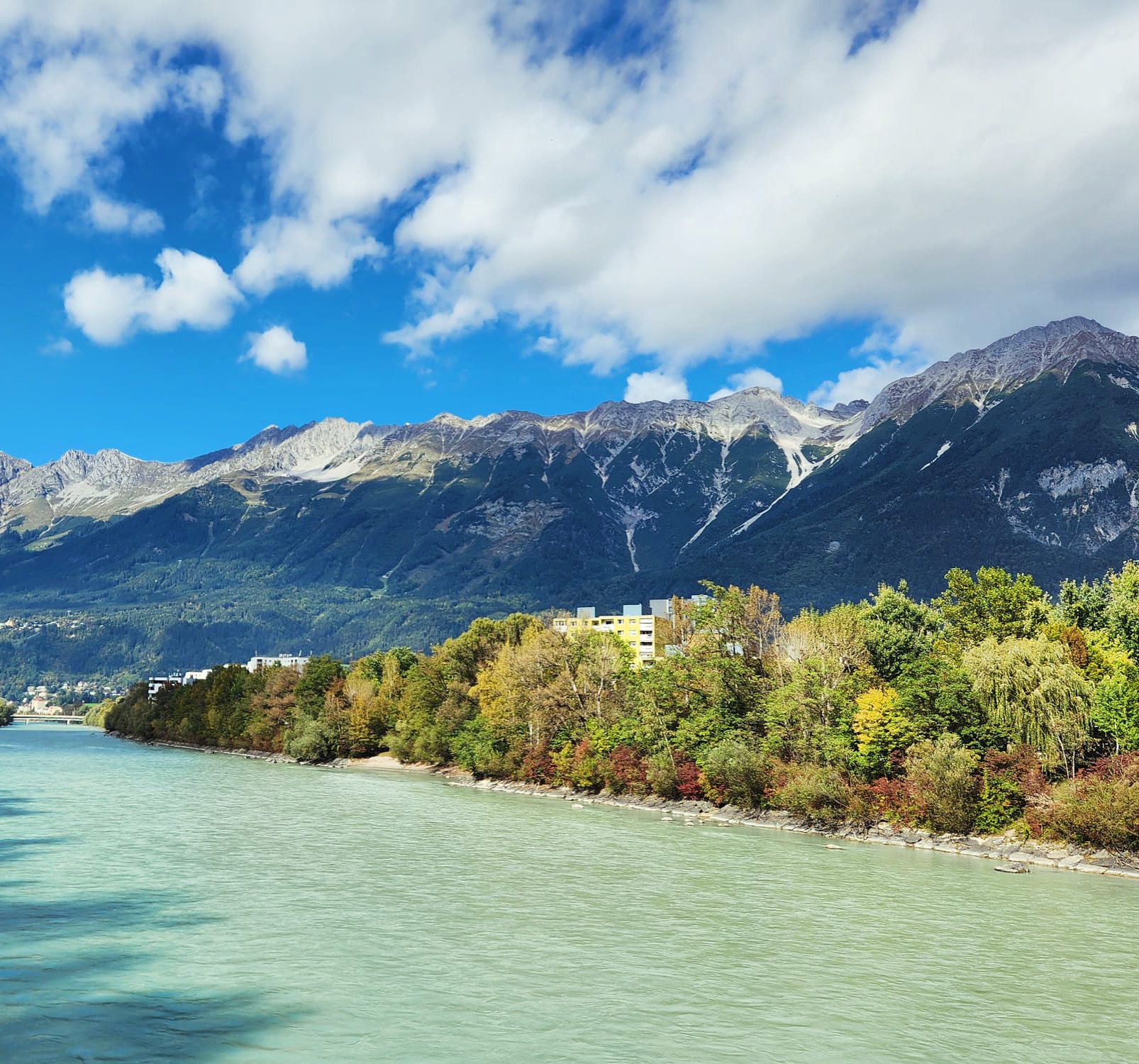
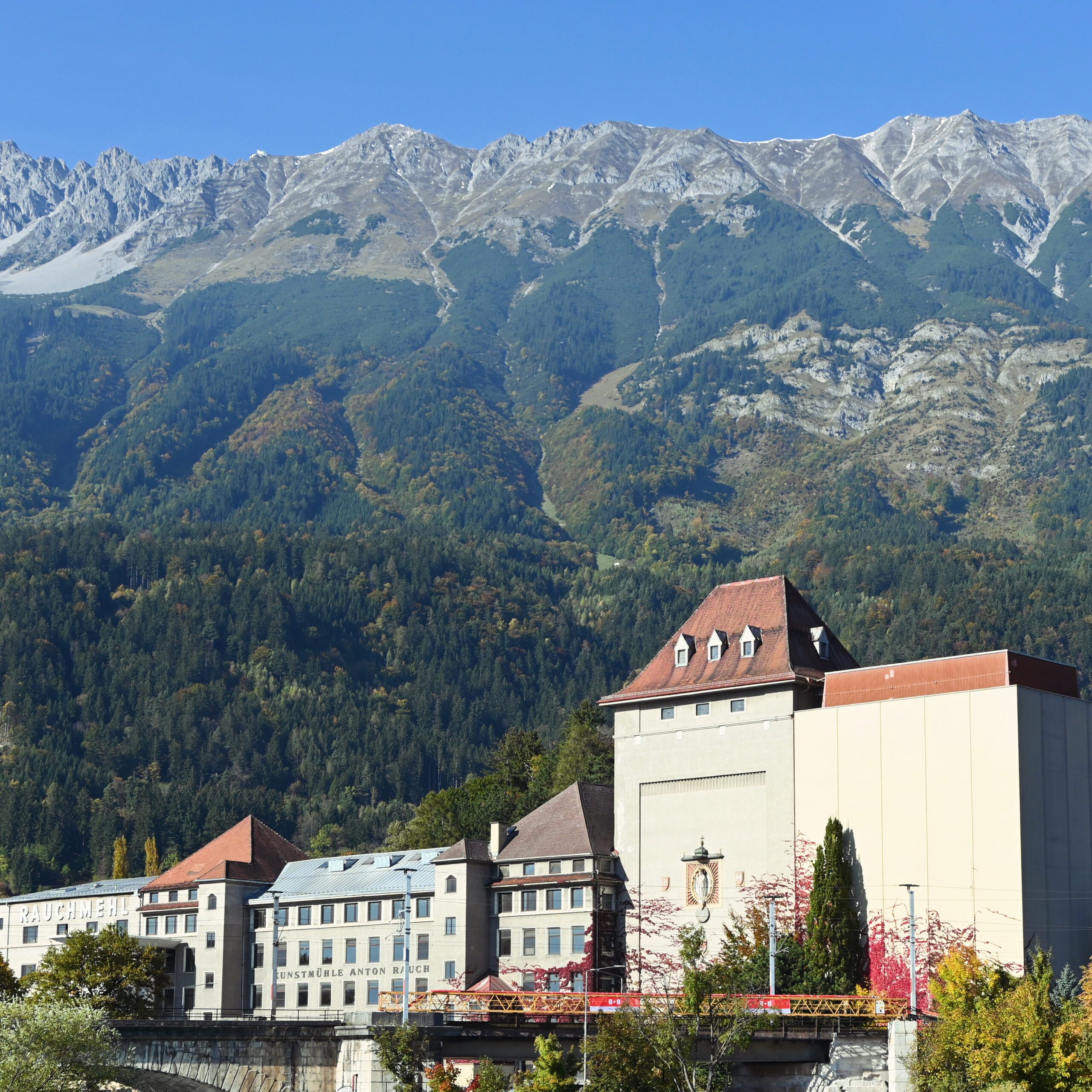
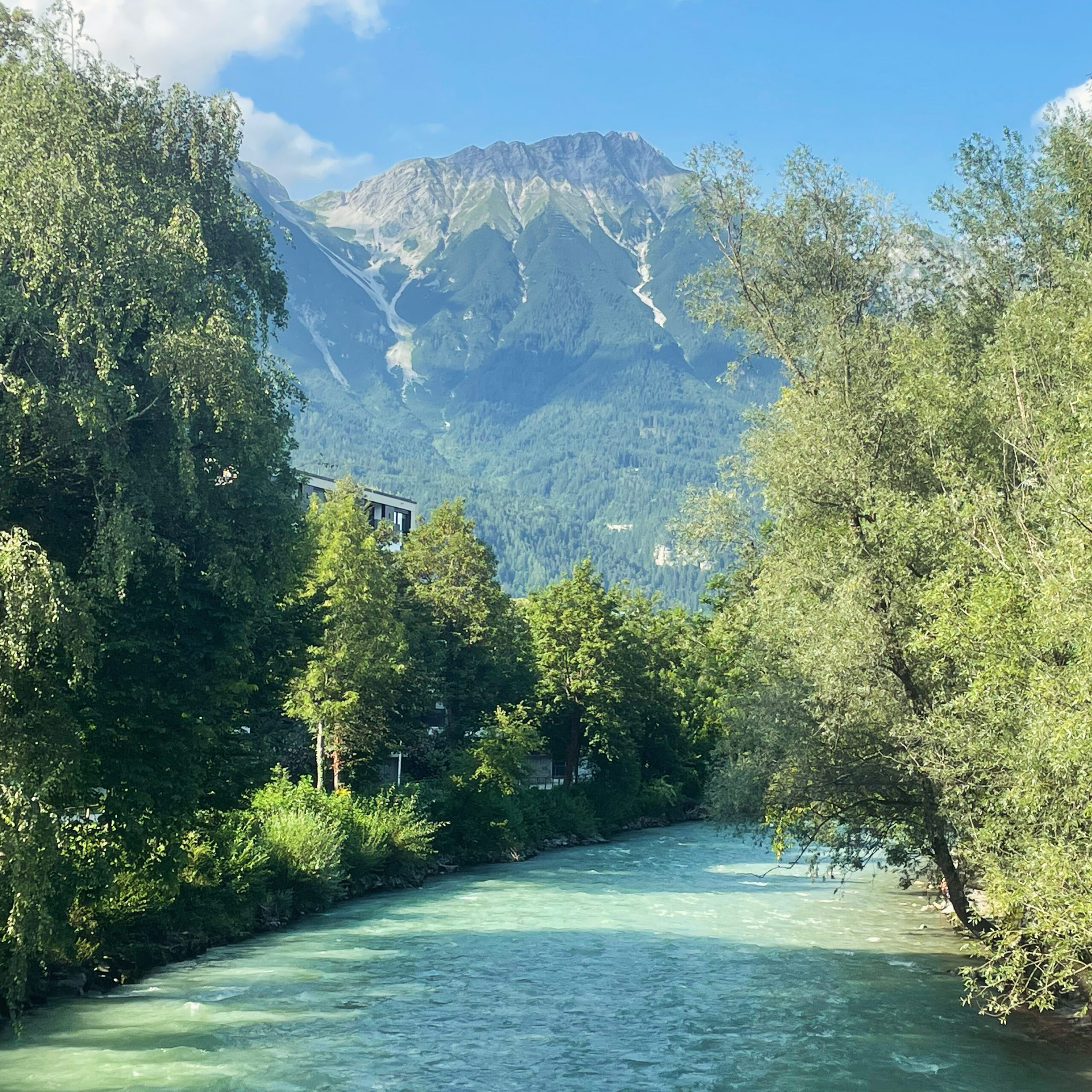
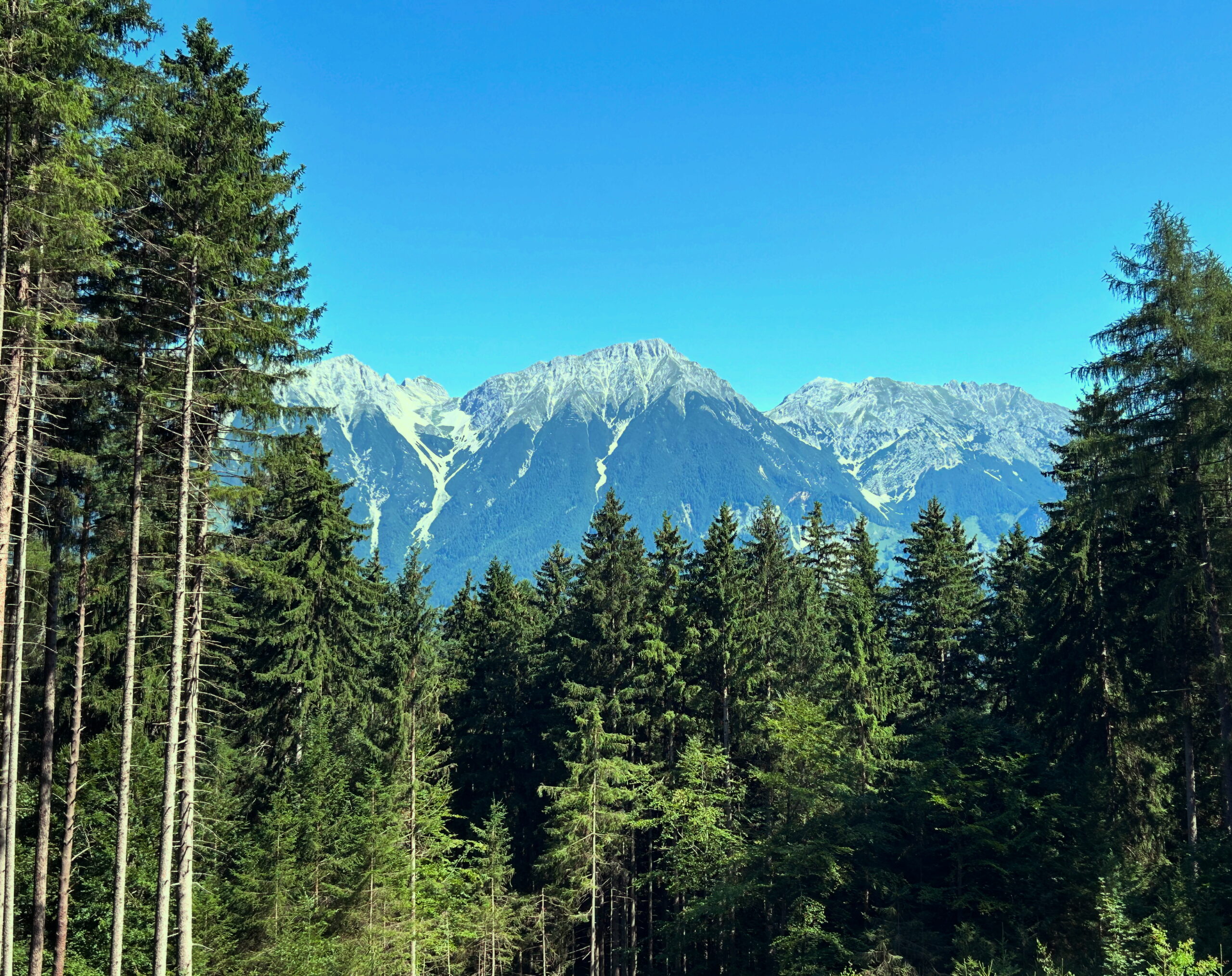
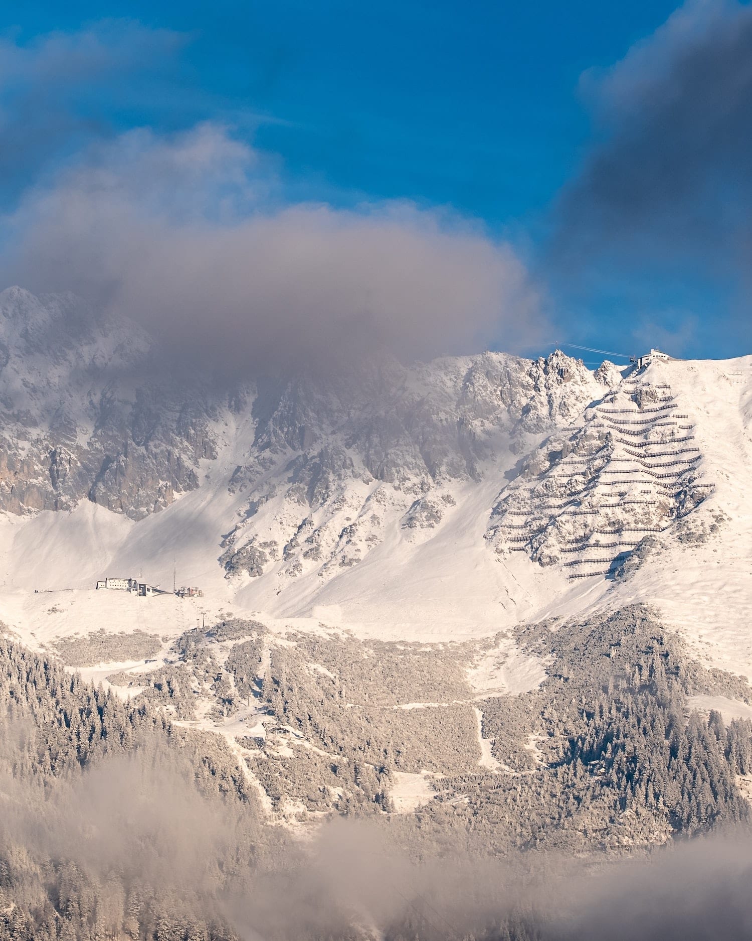
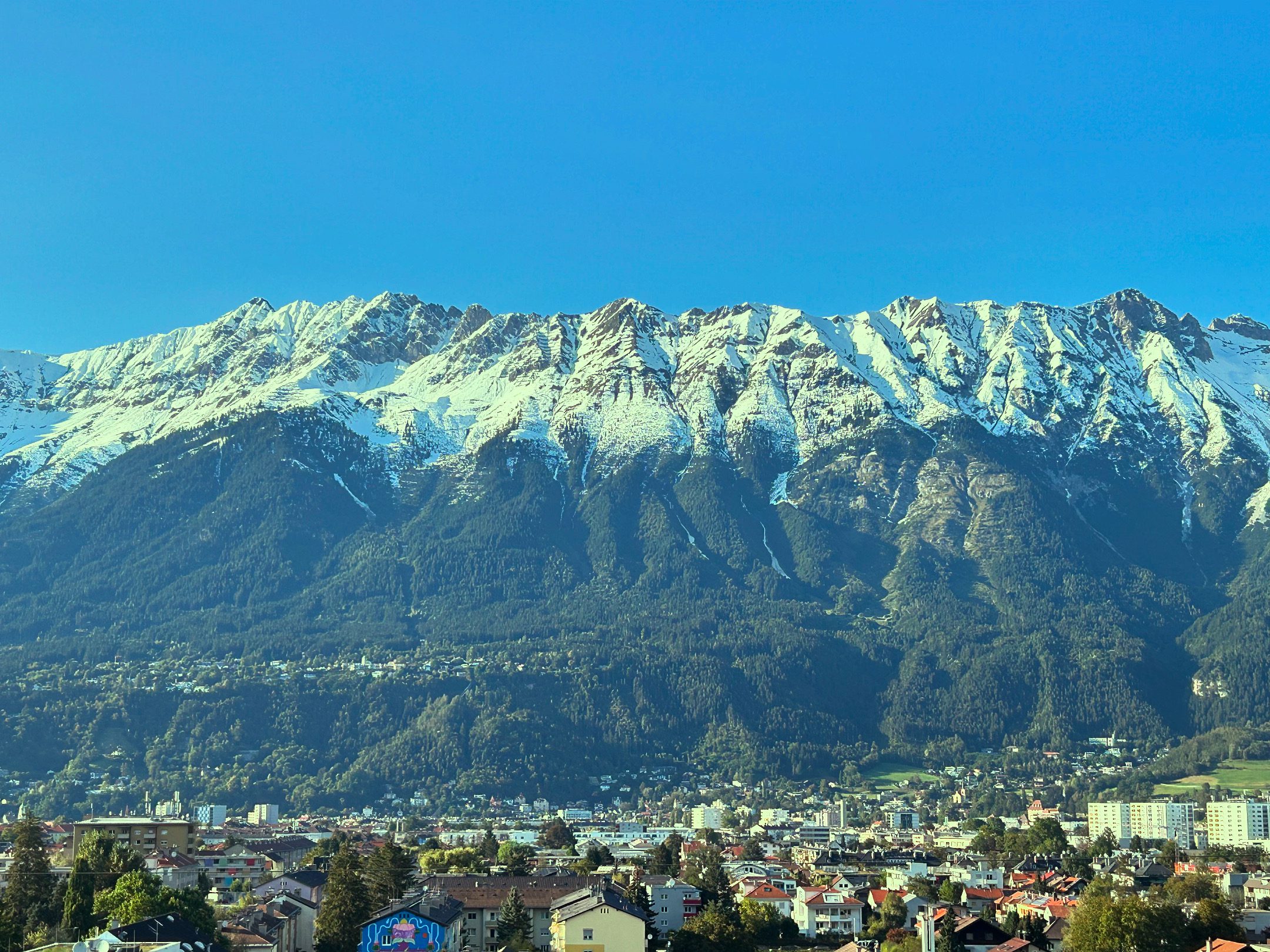
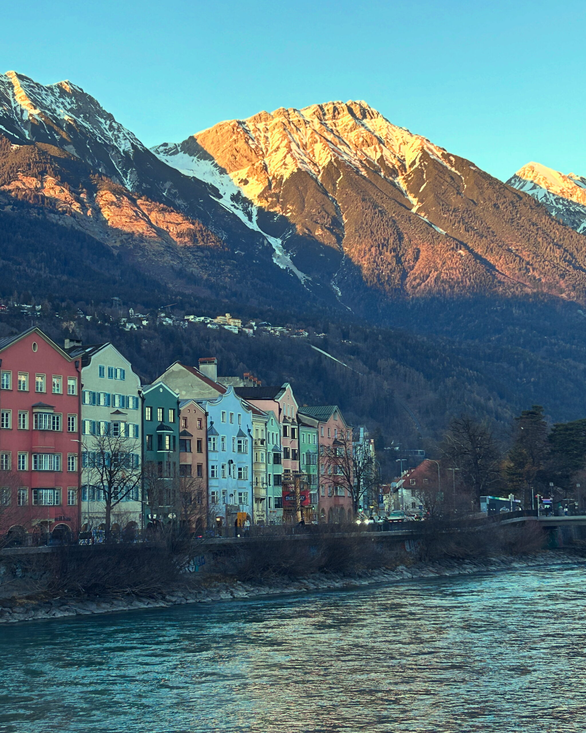
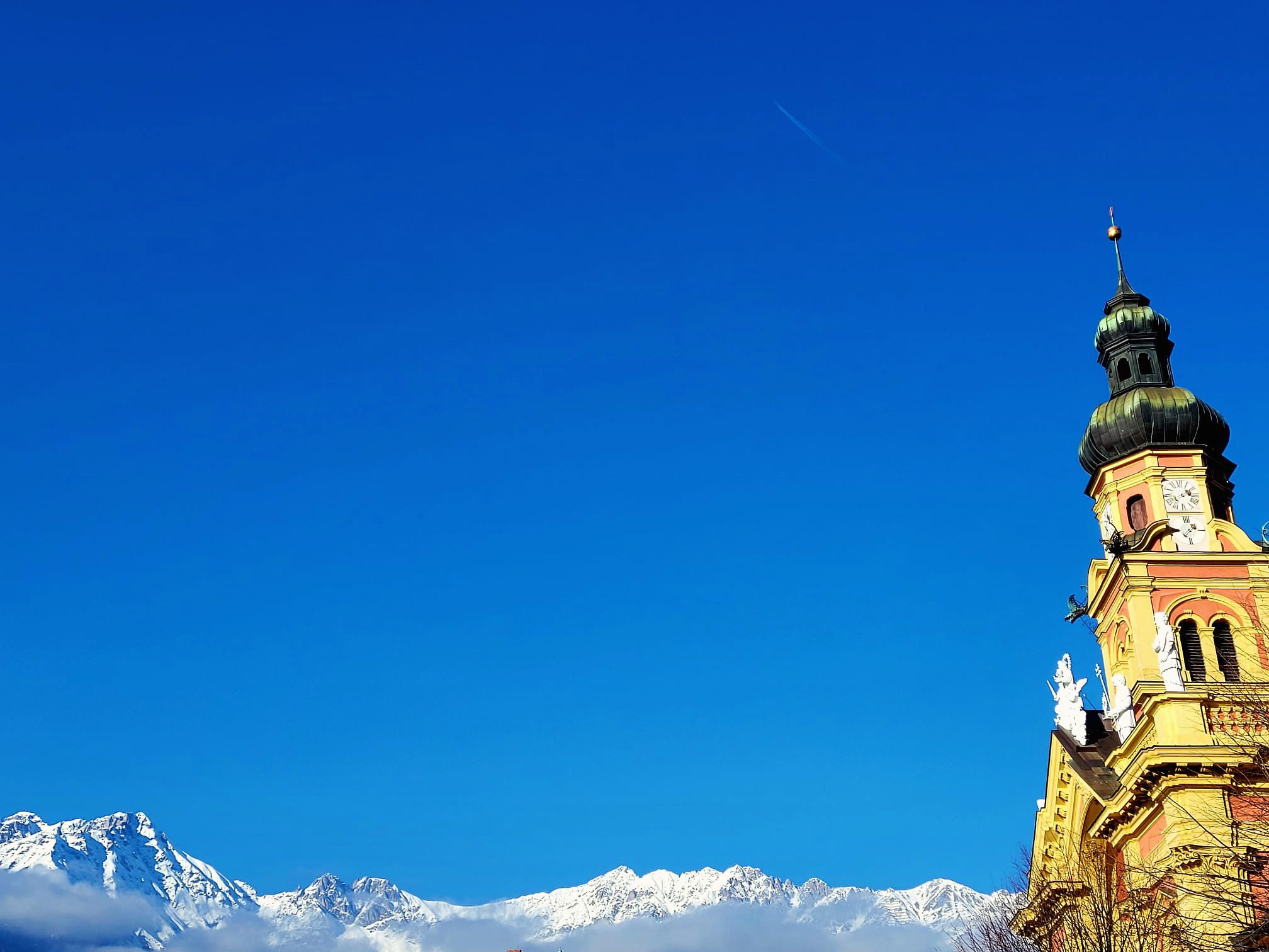
What most visitors to Innsbruck notice first and foremost are the mountains that seem to encircle the city. The mountains are not only beautiful to look at, but have always influenced many things in the city. This starts with supposedly small things like the weather, as the writer and politician Beda Webers' view from days gone by proves:
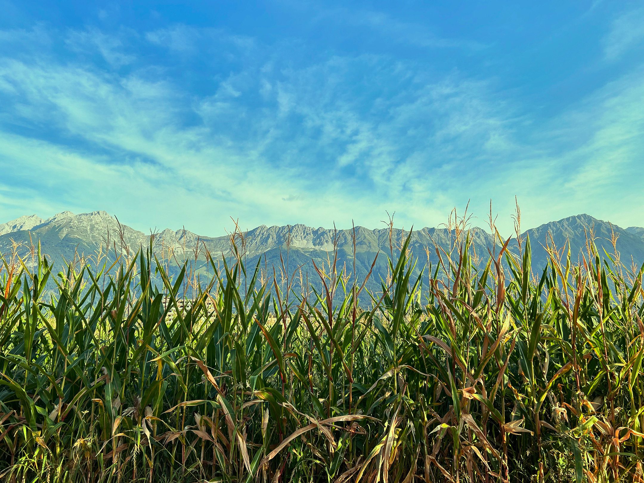
""The warm wind or scirocco is a special phenomenon. It comes from the south, bounces off the northern mountains and falls with force into the valley. It likes to cause headaches, but it melts the winter snow quickly and promotes fertility immensely. This makes it possible to plant maize in Innsbruck""
This weather phenomenon may take its name from Scirocco and traffic was not yet a major problem in 1851. However, just like the Innsbruck car driver today, the blacksmith in the old town in 1450 and the legionnaire sent from central Italy to the Alps in 350 were certainly complaining about the warm downdraught, which seems to drive everyone crazy several times a month. In the past, people were happy about the warm air that melted the snow in the fields, whereas today's tourists moan about the apery ski slopes on the Seegrube.
The location between the Wipptal valley in the south and the Nordkette mountain range not only influences the frequency of migraines, but also the leisure activities of Innsbruck residents, as Weber also recognised. "The locals are characterised by their cheerfulness and charity, they especially love shore excursions in the beautiful season." One may talk about Kindness and benevolence der Innsbrucker streiten, Landausflüge in Form von Wanderung, Skitour oder Radfahren erfreuen sich auch heute noch großer Beliebtheit. Kein Wunder, Innsbruck ist von Bergen umgeben. Innerhalb weniger Minuten kann man von jedem Ort in der Stadt aus mitten im Wald stehen. Junge Menschen aus ganz Europa verbringen ihre Studienzeit zumindest zu einem Teil an der Universität Innsbruck, nicht nur wegen der hervorragenden Professoren und Einrichtungen, sondern auch um ihre Freizeit auf den Pisten, Mountainbikerouten und Wanderwegen zu verbringen, ohne auf urbanes Flair vermissen zu müssen. Das ist Fluch und Segen zugleich. Die Universität als großer Arbeitgeber und Ausbildungsort kurbelt die Wirtschaft an, gleichzeitig steigen durch auswärtige Studenten die Lebenserhaltungskosten in der Stadt, die zwischen den Bergen eingeklemmt nicht weiterwachsen kann.
Was heute als Einschränkung im räumlichen Wachstum verstanden werden kann, war einst der Grund für das Wachstum. Innsbruck hatte das große Glück, durch die nahen Berge an frisches Trinkwasser zu kommen. Im 15. Jahrhundert zapfte man die Nordkette an, um die Stadt mit Trinkwasser zu versorgen. 1485 ließ der Gemeinderat die Quelle in Gramart beim heutigen Katzenbründlweg östlich der Hungerburg mit einer Leitung in die Stadt verlegen. Mit bis zu vier Meter langen Röhren aus Lärchenholz führte man das saubere Wasser in den Talboden. Bei der Innbrücke zweigte die Leitung links und rechts nach Mariahilf und St. Nikolaus sowie über den Inn in die Stadt und die Neustadt. Bis zur Erbauung dieses kleinen technischen Meisterwerks war Innsbruck wie andere Städte vom Wasser in den Brunnen abhängig. Das Wasser war häufig abgestanden und voll mit Krankheitserregern. Bier und Wein galten nicht umsonst als ungefährlicheres Alltagsgetränk als Wasser. Die Pest konnte man damit zwar nicht dauerhaft fernhalten, Typhus und Cholera waren aber weniger weit verbreitet als in anderen Städten. Nicht nur des Trinkwassers wegen stieg Innsbruck im 15. Jahrhundert von einem kleinen Handelsstützpunkt zur Residenzstadt der Tiroler Landesfürsten auf. Der Brennerpass ist sehr niedrig und erlaubt es, den Alpengürtel, der sich rund um Italiens Nordgrenze schlängelt, verhältnismäßig einfach zu überqueren. In den Zeiten vor die Eisenbahn Waren und Menschen mühelos von A nach B brachte, war die Alpenüberquerung harte Arbeit, der Brenner eine willkommene Erleichterung. Zwischen 1239 und 1303 war Innsbruck die einzige Stadt zwischen „Mellach and Ziller“ in the central Inn Valley, which had the princely right of settlement. Here, goods had to be transferred from one cart to the next within the regulated cartage system, an enormous advantage for Innsbruck's economy. Innsbruck was not quite as rich as Bolzano and had no political significance until the early 15th century, but became one of the most important transport and trade hubs in the Alpine region The former provincial capital of Merano had no chance against the city on the Inn between Brenner, Scharnitz and the Achen Pass in the long term due to its remoteness. Its location in the Alps also favoured tourism, which gained a foothold from the 1860s at the latest. Travellers appreciated the combination of easy accessibility, urban infrastructure and Alpine flair. With the development of the mountainous region by railway, it was easy to travel and spend leisure time in the mountains or at one of the spas without having to forego the comforts of city life. By the time they were tamed by the railway, the Alps had gone from being a source of problems to an economic factor. Gone were the times characterised by difficult agriculture; yesterday's enemy became a saviour.
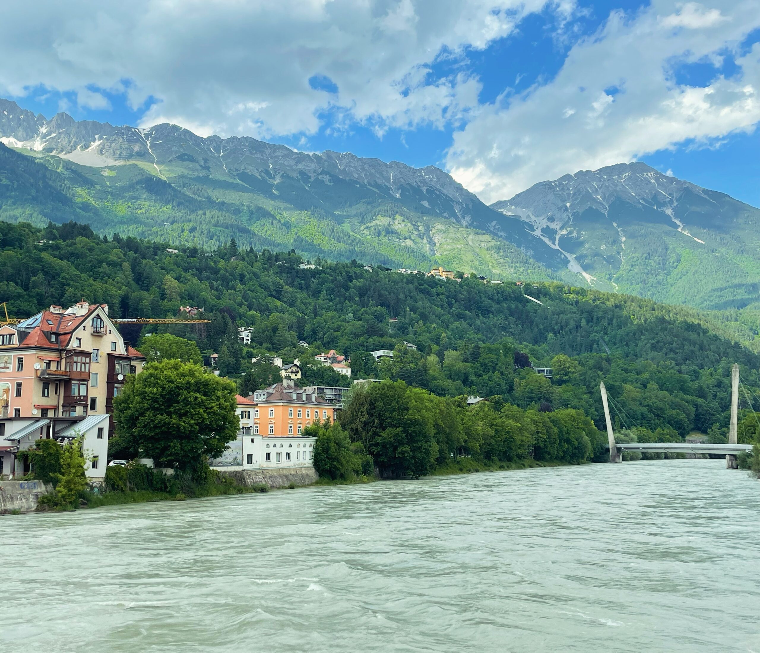
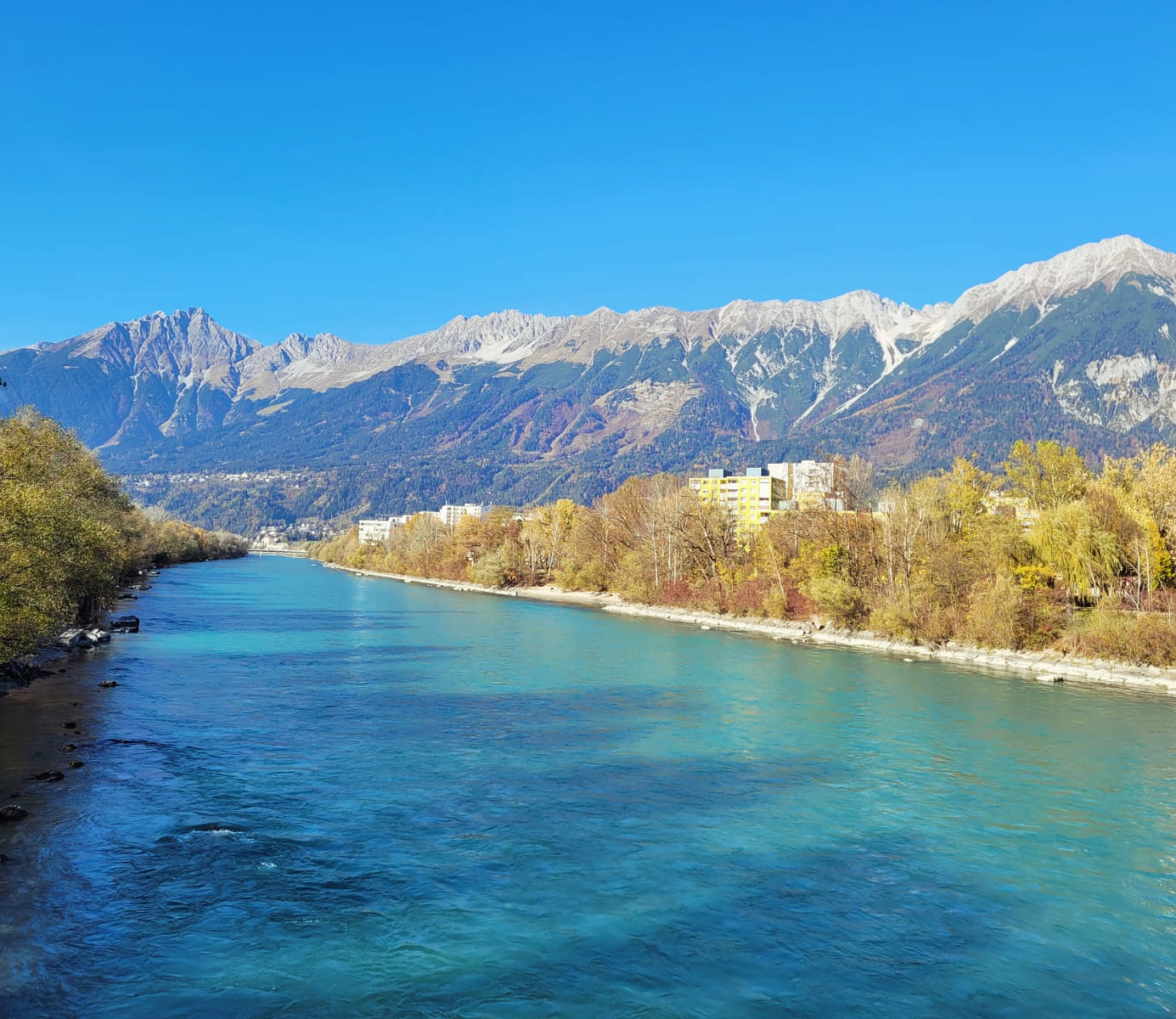
Neben den Bergen waren die Flüsse maßgeblich an der Entwicklung Innsbrucks beteiligt. Innsbrucks Trinkwasser kam zwar von der Nordkette über eine Wasserleitung in die Stadt, für die sanitäre Versorgung aber waren Inn und Sill zuständig. Das Vieh wurde am Inn zur Tränke geführt, die Wäsche gewaschen und Abfälle aller Art, inklusive Fäkalien von Mensch und Tier, entsorgt. Als die während der Industrialisierung zu wachsen begann, entstand am Sillspitz im Osten der Stadt eine erste Mülldeponie, die später um eine weitere im Westen am heutigen Sieglanger ergänzt wurde. Das Inntal war über 1000 Jahre nach der römischen Besiedlung noch immer ein sumpfiger, von Auwäldern durchzogener Landstrich. Siedlungen wie Wilten, Burgen wie die Festung über Amras und Straßen entstanden etwas vom Fluss entfernt auf Schwemmkegeln oder in Mittelgebirgshöhen. Rund um Innsbruck wurden die Auen als Allmende der Dörfer genutzt. Je nach Wasserhöhe standen Weideland und Brennholz zur Verfügung und der Fluss konnte als Transportweg genutzt werden – oder eben nicht. Flurnamen wie At the pouring in der Höttinger Au erinnern bis heute daran, dass der Inn am heutigen Stadtgebiet bis in die frühe Neuzeit ebenfalls nicht gebändigt, sondern mehr schlecht als recht kultvierte Wildnis war. Überschwemmungen waren immer wieder Folge des unregulierten Flusses. Zwischen 1749 und 1789 forderten mehrere Hochwasser in Innsbruck viele Tote. Auch der wirtschaftliche Schaden war immens. Die Innbrücke spülte Zolleinnahmen in die Stadtkassa und war der Grund, warum die Siedlung zur Stadt werden konnte.
Bis zur Verbesserung des Straßennetzes im 16. Jahrhundert herrschte zwischen Telfs, Innsbruck und Hall reger Schiffsverkehr. Die Flöße, auf denen die Waren transportiert wurden, waren flache Platten mit Dimensionen bis zu 35 x 10 Meter. Mehrere dieser Wasserfahrzeuge bildeten einen Zug, der am Inn bis zur Mündung in die Donau in Passau und weiter nach Osten Waren aller Art verschiffte. Silber, Baumaterialien, Holz, Salz, Weizen, Fleisch – die flussaufwärts auf Treidelwegen genannten Bahnen neben dem Flussbett von Pferden gezogenen Schiffszüge waren der schnellste Weg, um große Mengen an Waren möglichst schnell durchs Inntal transportiert zu bekommen. Auch das Militär nutzte den Inn als Logistikunterstützung. Vom Tiroler Oberland wurde über Jahrhundert hinweg Holz als Trift den Inn flussabwärts geschickt. In Hall fischte ein Holzrechen an der Innbrücke das kostbare Treibgut aus dem Wasser. Innsbruck, vor allem aber die Salz- und Silberbergwerke in Hall und Schwaz benötigten den Werkstoff und Energieträger. Nahe Siedlungen und Städten errichtete man befestigte Archen-Verbauungen, um den Fluss zumindest ein wenig zu zähmen und die Beeinträchtigung von Hochwasser und Dürre einzudämmen. Im 18. Jahrhundert förderten Ökonomisierung und Verwissenschaftlichung, die sich in allen Lebensbereichen bemerkbar machten, auch die Kultivierung der Landschaft. Von diesem Geist der Aufklärung erfasst, wurde auch die Optimierung des Inns als Transportweg und die Erhöhung der Wirtschaftlichkeit des verfügbaren Bodens in Angriff genommen. Die Allmende entlang des Inn wurde mehr und mehr in die Obhut einzelner Grundherren gegeben, die die Urbarmachung dieses Schwemmlandes vorantrieben. Der Theresianische Staatsapparat wollte das habsburgische Riesenreich nicht nur am Landweg mit Straßen, sondern auch über die Hauptflüsse verbinden. Die Verantwortung für Regulierung und Verbauung des Inns ging von den Gemeinden und der Saline Hall auf den Staat über. Innsbrucks erster Chief ark inspector Franz Anton Rangger began mapping the Inn in 1739 in order to make the course of the river easier to plan and faster by straightening and damming it. The project of taming the river was to take more than 100 years. The Napoleonic Wars delayed the construction of the facilities. It was only after the economic hardship of the early 19th century that the state was able to continue the project. Blockstone dams gradually replaced the ark defences. By the time the Inn had been tamed, the railway had replaced shipping as a means of transport. The next major wave of engineering works on the Inn came in the second half of the 20th century. The Olympic Village, the motorway and settlements such as Sieglanger required space that had previously been withheld from the river in order to facilitate the economic miracle of the post-war period.
The smaller river that crosses Innsbruck was almost as important as the Inn. Where the Sill leaves the Sill Gorge today, the Sill Canal was created to supply the city with water. When the Counts of Andechs founded the market at the Inn bridge in 1180, the canal already existed, as the mill of Wilten Abbey in St. Bartlmä was already in operation. From here, the canal continued along the route Karmelitergasse, Adamgasse, Salurnerstraße, Meinhardstraße, Sillgasse, Ing.-Etzel-Straße to Pradler Brücke, where it reconnected with the Sill before flowing into the Inn. Initially intended primarily for fire protection, many businesses soon utilised the water flowing through the town to operate mills for power generation. It was not until the 1970s that the last parts of it disappeared after bombing damaged it during the Second World War.
The final geographical ingredient in the city's success story is the broad valley basin, which favoured Innsbruck's development. As the city grew and the population increased, so did the demand for food. While the farmers in the higher side valleys faced harsh conditions, the Inn Valley offered fertile soil and land for livestock farming and agriculture. Until the High Middle Ages, the Inn Valley was much more heavily forested. In the 13th century, as in many parts of Europe, the area around Innsbruck was subject to major and long-term human intervention in nature for economic purposes. Contrary to what is often portrayed, the Middle Ages were not a primitive time of stagnation. From the 12th century onwards, people no longer relied on prayers and God's grace to escape the effects of regularly occurring crop failures. Innovations such as three-field farming made it possible to feed the agriculturally unproductive urban population, known in modern parlance as the Overhead would call it. The reclamation of the land allowed the town to grow. The towns such as Schwaz, Hall and Innsbruck could not feed themselves, and considerable food imports were required, especially in the early modern period during the mining boom. In addition to meat, it was mainly wine that came to the county of Tyrol from abroad for a long time. Without the local farmers, however, Innsbruck would not have been able to survive. Corn, which Beda Weber considered worthy of mention in Innsbruck's cityscape as early as 1851, is still growing vigorously and even today gives large areas on the outskirts of the city an agricultural flavour.