Wilten, Sieglanger & Mentlberg
Things to know about Wilten
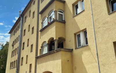
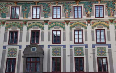
Following archaeological findings with well‑meaning attention, one could describe Wilten as the birthplace of Innsbruck. Between Bergisel and the Olympic Bridge, excavations uncovered numerous graves, wall remains, coins, pottery, and water channels that shed light on ancient times. With the Roman settlement of the Inn Valley around the turn of the era, a military base was established here. After the fall of the Western Roman Empire in 476 AD, Tyrol slowly and gradually came under the control of the Duchy of Bavaria. From the Roman Castrum Veldidena developed the Locus Wiltina, which first appeared in written records in the year 806. When the Bavarian Counts of Andechs began establishing the market settlement on the southern bank of the Inn in 1180—out of which Innsbruck would emerge—Wilten already had roughly 1,000 years under its belt. This seamless transition from Roman to Bavarian rule without loss of importance was owed to Wilten’s ecclesiastical structures. Christianity and the Wilten Abbey were already firmly established institutions. The new rulers were more than happy to take over the local administrative center at Wilten Abbey. This would have long-lasting consequences. Until 1561, the abbots successfully prevented the establishment of additional monasteries in Innsbruck in order to maintain the abbey’s sphere of influence in the town. Only during the Counter-Reformation did the local ruler—later Emperor Ferdinand I, originally from Spain—succeed in settling the Jesuits in the city, despite disregarding many local customs, in order to make the residential capital more independent. Still, major holiday masses such as Christmas and Easter, as well as baptisms, continued to be celebrated in Wilten. Economically, Wilten long developed in step with Innsbruck, although a customs border separated them. The settlement had no city rights, no walls, and no city tower, yet the village grew eagerly northward from the abbey. Between the Triumphal Arch and the Basilica, as well as at St. Bartlmä along the Sill, not only farmers but also craftsmen settled. The abbot collected the tithe and oversaw not only spiritual but also worldly matters of his community. With the civil reforms and industrialization of the 19th century, Wilten and Innsbruck grew together economically and socially. Innsbruck citizens owned businesses in Wilten and vice versa. Beginning in the 1860s, along the old field paths south and west of the city—then still dominated by agriculture—residential buildings emerged between Innrain and Südring, many of which still exist today and housed employees and workers. West of Anichstraße, a major infrastructural facility arose with the construction of the new municipal hospital. Several of the first historic clinic buildings built after 1885 still stand between modern high‑rises and glass towers, which today almost form a medical district of their own. The customs border at the Triumphal Arch increasingly became an absurdity. Foodstuffs such as beer, wine, meat, and grain traded between Innsbruck and Wilten had to be taxed. The customs house was widely hated, as it made everyday life unnecessarily expensive and complicated. In 1904, Wilten was officially incorporated into Innsbruck. The customs station visible in archival photographs—the Accis-Häuschen—made way for the general store “Wiener Bazar” after the abolition of domestic customs duties. The last municipal leader Fritz Heigl (1856–1923) and planner Rudolf Tschamler negotiated the necessary details and requirements with a committee under Innsbruck’s mayor Wilhelm Greil—customs being only one of many issues. Wilten’s population had tripled within just a few decades. The necessary and costly infrastructure could no longer be maintained by the municipality alone. Water and electricity transformed everyday life and living standards but first had to be financed. Around 1900, Wilten had only one school for more than 10,000 inhabitants, while Innsbruck had six for 25,000. Joint modernization was organizationally and financially sensible—though longtime Wilten residents would lament the loss of village character for decades, even if Wilten’s band and rifle company continued to receive funding as part of the merger agreement with Innsbruck. With the opening of the first tram line from Bergisel through Wilten to the main railway station in 1905, the marriage between the two places became reality. Many signs still testify to this growth and the incorporation around the turn of the century, largely directed by Greater German liberal politicians. In Wilten, the popular “heroes” of the Tyrolean uprising of 1809 remain immortalized in street names such as Andreas-Hofer-Straße, Speckbacherstraße, or Haspingerstraße. A short walk from Anichstraße through Kaiser‑Josef‑Straße, Speckbacherstraße, Stafflerstraße, and Sonnenburgstraße provides a good impression of urban planning between 1880 and 1945. The Gründerzeit houses are just as worth seeing as the South Tyrolean Settlement. Johann von Sieberer had the Union Fountain built at the train station to commemorate the merger of Wilten and Innsbruck, which was removed under National Socialism to create more space for traffic. Two boundary stones with the coats of arms of Innsbruck and Wilten, built into the oriel of the Hotel Goldene Krone on Maximilianstraße—formerly the border street—also recall this history. Today, Wilten is a diverse and vibrant district. Between the upper village around Gasthaus Haymon, Wilten West near the cemetery, and the Triumphal Arch, one finds traditional and modern urban life side by side. Functional residential buildings from the 1960s and 1970s meet Gothic and Gründerzeit architecture.
Wissenswertes Sieglanger & Mentlberg
The western adjoining district of Sieglanger and the Mentlberg rising above it have always been closely connected with Wilten. A landed estate was first mentioned in 1305 as a fief of Wilten Abbey. The estate on the Gallwiese comprised several hectares of land and forestry rights on the Wiltenberg. Where the manor Felseck and several residential buildings now stand, a watchtower remained in place well into modern times. Using signal fires—so‑called Kreidfeuer—the city could be warned of approaching danger. The abbots of Wilten spent their summers on the Wiltenberg, enjoying the warm season at a spatial distance from monastery politics. Heinrich Mentlberger, owner of today’s Weinhaus Happ, city judge, and mayor, purchased the estate on the Gallwiese from Wilten Abbey in 1485. This energetic contemporary of Emperor Maximilian was elevated to the nobility by his sovereign as a member of the Imperial Council, turning Mentlberg from a rural estate into the eponymous baronial manor. Over the following centuries, numerous changes of ownership occurred within the aristocracy before Leopold Lindner acquired the property in 1884. Lindner did not come from the nobility, but his ancestors, through their business Rosenbachers Eidam based in Wilten, had amassed a considerable fortune as court suppliers of wax goods. Like other industrialists of his time, he invested his capital in the growing tourism sector. In this pioneering, gold‑rush era of tourism, Lindner recognized the potential of the property. Innsbruck and its surroundings already had several establishments that capitalized on the healing powers of water. In Egerdach and Mühlau, two successful spa and bathing operations existed. The bathhouse Ferneck, further east on the Wiltenberg, was already a well‑established bathing and entertainment venue where Innsbruck residents took the waters—considered beneficial for various ailments—while enjoying food and drink. Under Lindner, a hotel pension was created in the aristocratic setting of the Mentlberg, reminiscent of a modern wellness hotel. Guests enjoyed treatments such as pine‑needle baths, brine baths, and mineral baths. Officially since 1874, the traditional inn Peterbrünnl served food and drink to visitors. The name of the inn goes back to Peter Anich (1723–1766), the highly revered Tyrolean cartographer who is said to have rested and refreshed himself at the “Brünnl” beside the bathhouse during his foot journeys from his hometown Oberperfuss to Innsbruck. The old fountain trough in front of the inn dates back to 1897; the bird‑shaped water‑spouting fountain was likely added later.
Der heutige Sieglanger wurde erst lange nach dem Mentlberg erschlossen. Auf historischen Karten kann man die Unterschiede zwischen dem unverbauten Zustand 1930 in verschiedenen Etappen bis hin zur ausgebauten Siedlung ab 1980 nachverfolgen. Der Platz am Inn war als Lower Figge bekannt und unverbaut. Nach dem Zweiten Weltkrieg folgte eine Verdichtung des Sieglanger. Seine große Zeit kam in der Zeit des Wirtschaftswunders nach dem Zweiten Weltkrieg, als immer mehr Menschen in die neu errichteten Wohnanlagen am Stadtrand zogen. 1962 wurde die Kirche Maria on the shore eröffnet, um die neuen Einwohner auch seelsorgerisch bedienen zu können. Das Gotteshaus mit dem markanten, von weitem gut sichtbaren Turm und die Betonglaswand mit den bunten Fenstern nach Plänen Max Weilers ist ein Denkmal des Aufbruchs Tirols. Zwei Jahre später kam es zum Bau der Autobahn, einer wenig pittoresken Begrenzung des Stadtteils. Seit 1977 verbindet der monumentale Sieglangersteg mit 147 m Stützweite über Autobahn und Inn hinweg den Sieglanger für Radfahrer und Fußgänger mit zwei anderen Siedlungen, der ehemaligen Siedlung Neustädter Stürmer am Lohbach und der Höttinger Au.
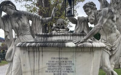
Western cemetery
Fritz-Pregl-Straße
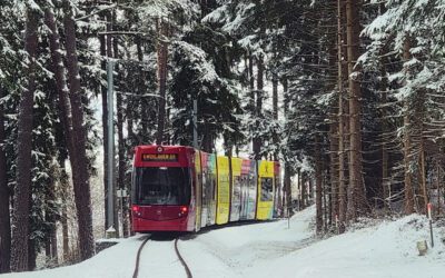
Tram line 6
Stops: Mühlau - Igls
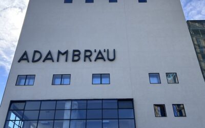
Adambräu & Ansitz Windegg
Adamgasse 23
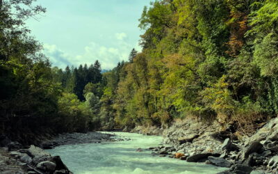
Sill Gorge
Wilten
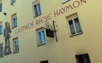
Haymon Giant Inn
Haymongasse 4
Tyrolean Glass Painting and Mosaic Institute
Müllerstrasse 10
Sonnenburgplatz
Sonnenburgstraße
Leopoldstraße & Wiltener Platzl
Leopoldstrasse
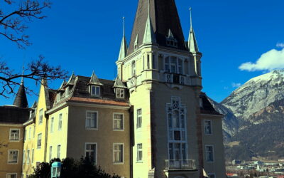
Mentlberg Castle & Pilgrimage Church
Mentlberg 23
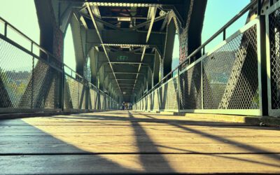
Karwendel bridge
Karwendel arches
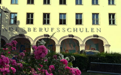
Provincial vocational school
Mandelsbergerstrasse 16
Fraternity House Austria
Josef-Hirn-Straße
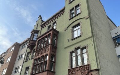
South Tyrolean settlement Wilten West
Speckbacherstrasse
Johanneskirche
Bischof-Reinhold-Stecher-Platz
Dollfußsiedlung & Fischersiedlung
Weingartnerstrasse
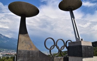
Mountain Isel
Mountain Isel 1
Winklerhaus
Leopoldstraße/Maximilianstraße
University of Innsbruck
Innrain 52
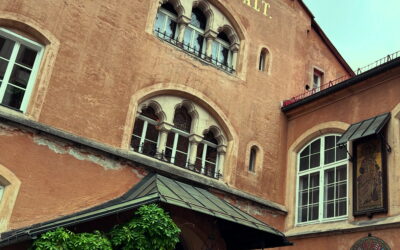
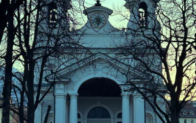
Wilten Abbey & Basilica
Klostergasse 7 / Pastorgasse 2