Pradl & Amras
Things to know about Pradl
The name Pradl likely derives from the Latin expression Pratellum, meaning “small meadow,” which points to Roman settlement in the area. According to Innsbruck’s city chronicle, the name Pradl was mentioned in documents for the first time in 1178. Until the industrialization of the 19th century, Pradl was a cluster of farmhouses east of Innsbruck. When the cotton-spinning mill Herrburger & Rhomberg (1839), the Epp soap factory (1885), and the municipal gasworks (1859) were established in the 19th century, the village grew rapidly. By 1900, what is today Innsbruck’s largest district already had about 2,000 inhabitants. With the construction of the railway station, the city had expanded to its limits, and Pradl had become a key location for energy and infrastructure. The gasworks, located where Rapoldipark stands today, transformed not only the former village but the entire city. In 1861, Innsbruck’s gas lighting began. Around the turn of the century, more than 500 gas lamps illuminated the city. Increasingly, kitchens were also operated using gas. The major drawback of gas production was that it relied on burning coal. Smoke and dust polluted the air directly next to residential houses and farms. While Innsbruck benefited from industrialization, Pradl primarily experienced its negative consequences: overpopulation, rapid disruption of social structures, and pollution. The residents themselves did not enjoy the positive sides of modernization. Despite its growth, the area lacked the funds needed to expand infrastructure. Sewage systems, streets, schools, healthcare, and public transport were largely absent. Well into the 20th century, drinking water in Pradl caused typhoid; modernization was barely noticeable. This changed only after incorporation. In 1904, the village became part of Innsbruck. Until then, Pradl and its southern neighbor Amras formed a single municipality. At a town meeting in 1902, a significant majority of Pradl’s residents voted for incorporation. In Amras, however, the majority voted against it, which meant Pradl had to split from Amras first in order to join Innsbruck. From 1912 onward, a tram line connected Pradl with the city center.
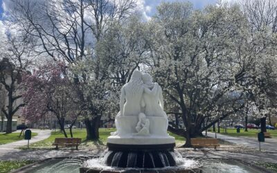
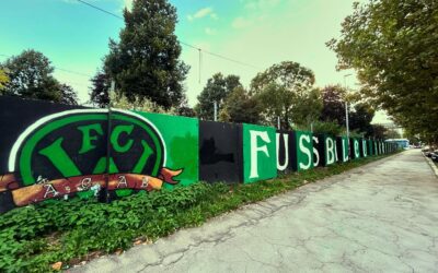
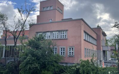
In the 20th century, Pradl increasingly developed into a residential district. South of the former village center by the Florianibrunnen, multi‑story rental houses in the traditional Heimatstil or classical historicism were built to house factory workers and employees. Beautiful examples remain in Pradlerstraße, while simpler ones can be found along the Sill and in Gabelsbergerstraße. Although factory workers still belonged to the poorer segments of society, they did not suffer the extreme destitution that the proletariat faced in large industrial cities under unregulated capitalism. This may have been one reason—alongside the strong influence of the Church—why communism and socialism gained traction only slowly in Tyrol. In 1927, to alleviate the worst social hardship of the post‑war years, a homeless shelter was opened on Hunoldstraße. Just a few steps away, Rapoldipark offered residents leisure space. Around the same time, between Pradl and Amras, the so‑called Kaufmann Blocks—known locally as “Stalingrad”—were built in the International Style. With their courtyards and cubic forms, they are now protected as historic monuments. The Pembaur block was also built in the 1920s, though in a more progressive architectural style. Between 1939 and 1945, the South Tyrolean settlements in eastern Pradl sprang up rapidly under National Socialist planning. Eichhof, Ahornhof, and Lindenhof, with their large interior courtyards, still shape the district today. But perhaps the most significant transformation of Pradl came with the redevelopment of the Tivoli area from the year 2000 onward. Where fans and players of Innsbruck’s football clubs once cheered and celebrated, a completely new neighborhood emerged—featuring over 400 apartments, a retirement home, a kindergarten, playgrounds, supermarkets, office buildings, and a skate park.
Things to know about Amras
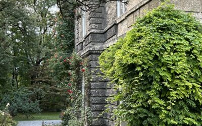
Amras can be traced back even further than Pradl. Ecclesiastically, Amras did not belong to the Wilten Abbey until 1256, but instead to the village of Ampass on the hillside above, which fostered an administrative and cultural distinctiveness still noticeable today. Many “true Amras locals” continue to feel that they are inhabitants of their own village—being Innsbruckers only in second place. The first farmhouses were mentioned in writing as early as the year 837 under the name locus omeras. Shortly afterwards, the Counts of Andechs built their castle of the same name above the village. The name likely refers to the shady location at the foot of the Patscherkofel. The Latin ad umbras means “by the shadows.” Much of this now densely populated area would be unrecognizable today. Where the Südring, now one of the city’s main traffic arteries, cuts through the landscape and the DEZ shopping center adjoins what remains of the old village core, the Amraser See once stretched until the 19th century. Over time it silted up, and today it exists only in old pictures. Emperor Maximilian had fish bred here to ensure that he and his court would not have to go hungry even on Christian fasting days. Until the 1960s, visitors could spend their holidays at the Seewirt campsite before the meadows and open spaces—following the typical automobile‑centered urban development of the post-war boom—were paved over in the interest of commerce. According to an art historical study by Wilhelm Fischer from 1951, the famous painting Winter Landscape by the Dutch painter Pieter Bruegel (c. 1525–1569), housed in the Kunsthistorisches Museum in Vienna, offers an impression of early modern Amras. Bruegel, alongside the apocalyptic Hieronymus Bosch, was one of the most important masters of 16th-century Flemish painting. Between 1552 and 1555, after training in Antwerp, he traveled to Italy to immerse himself in Renaissance art. This period marked the beginning of the Little Ice Age, which lasted—with regional variation—from the 15th to the 19th century. In Tyrol, this climatic change led to unusually frequent crop failures, economic disruption, and supply shortages. On his return journey to Northern Europe, Bruegel stopped in Innsbruck and drew inspiration from its landscapes and people. Unlike Albrecht Dürer, who a few years earlier had painted a well‑known watercolor of Innsbruck's cityscape, Bruegel—true to his style—captured an everyday scene. Although the setting of the painting is placed in the Netherlands, as indicated by certain details such as the inn sign, the wintery, alpine landscape closely matches the perspective visible from today’s district, looking north. In the foreground, we see a hunting party presumably returning from the then‑unwalled Ambras Castle toward the Inn Valley. In the background, adults and children skate and play on the frozen lake against the backdrop of the Karwendel range and the Inn Valley. The rural village of Amras and its lively winter activities appear to have left a lasting impression on the artist, who painted the scene in oil twelve years later. Thirty‑four years after Pradl, Amras was incorporated into the city of Innsbruck in 1938 as part of the nationwide municipal reorganizations under the National Socialists, against the will of the majority of its residents. As a result, the construction of larger urban housing developments began later here, which is reflected in the local architectural style. While many houses in Pradl date from around the turn of the century, the residential blocks in Amras are dominated by the often unadorned post‑war architecture. However, in certain streets such as Philippine‑Welser‑Straße, several beautiful old farmhouses have survived—structures that reflect both the traditional self‑image of Amras and the prosperity that local farmers have achieved today.
34 Jahre nach Pradl wurde Amras im Rahmen der reichsweiten Eingliederungen unter den Nationalsozialsten 1938 gegen den Willen der Mehrzahl der Bürger an die Stadt Innsbruck angeschlossen. Der Bau von größeren urbanen Wohnhäusern nahm somit erst später seinen Anfang, was sich im bis heute dominierenden Baustil niederschlägt. Während in Pradl viele Häuser aus der Zeit um die Jahrhundertwende stammen, werden die Wohnblöcke in Amras von der oft wenig ansehnlichen Nachkriegsarchitektur dominiert. In einigen Ecken wie der Philippine-Welser-Straße befinden sich aber noch einige der schönen Bauernhäuser, die den Stadtteil im Amraser Selbstverständnis ebenso darstellen wie den Wohlstand, zu dem die Landwirte mittlerweile gekommen sind.
Interesting facts about Igls & Patscherkofel
The upland region south of Amras, on the slopes of Innsbruck’s Olympic mountain, the Patscherkofel, is home to Vill and Igls—two formerly independent villages that have been politically part of Innsbruck since 1942. In a sense, the very first Innsbruckers who left their traces lived here above the valley floor. Just above Igls lies the archaeological site of Goldbichl. Not much remains of the cult site that was destroyed in 15 BC during the Roman conquest, but information boards provide concise insights into the culture of the Breuni. Igls was also an early pioneer in tourism. While Vill has preserved its rural character to this day, the village center of Igls feels like a journey back to the era of the late-19th‑century summer holidaymakers. At 950 meters above sea level, the village was popular with both Innsbruck residents and visitors as an excursion and holiday destination. Michael Obexer was one of the pioneers who recognized Tyrol’s tourism potential early on. In 1870, he transformed the small inn “Gasthof Neuwirth” into the Hotel Igler Hof, allowing the village to rise quickly into the top tier of Tyrolean tourist destinations. The facade of the Sporthotel Igls and the spa park with its pavilion still reflect the elegance of the Belle Époque spa culture. Two world wars and nearly a century later, Igls returned to the international stage after some less prosperous decades. The bobsleigh track and the Patscherkofel served as venues during the Olympic Games. Early plans to build an aerial cable car to the Patscherkofel—aimed at putting Innsbruck on par with major Swiss resorts—began around the turn of the century under the guidance of the Innsbruck city council and Max Obexer. The outbreak of World War I halted the project just after the road up to Heiligwasser had been paved. In 1924, the plans were revived. The initial enthusiasm for a version running from Bergisel up to the mountain hut below the summit was interrupted by the hyperinflation of the First Republic. Only after the introduction of the schilling could the project proceed, albeit in a reduced form. The valley station was built near the struggling “Mittelgebirgsbahn,” today’s tram line 6. The planning and financing phase became a fiasco, with the budget exceeded by about 50%. Nevertheless, the railway opened in 1928. After several ownership changes, it was replaced in 2017—again accompanied by poor financial planning on the city’s side—by a new, modern cable car starting directly at the ski slope instead of the village center. A short walk above the valley station, at more than 1,200 meters elevation, the Alpine inn and the pilgrimage church of Heiligwasser invite visitors to rest. The hosts are the Premonstratensian order, who lease out the alpine pasture. The small Baroque church was built in 1651 after, according to legend, a deaf‑mute child was miraculously healed at the spring. From the terrace of the inn, visitors can enjoy a magnificent panoramic view of the city after their walk—much like Emperor Franz Joseph I, who stayed overnight at Heiligwasser during his ascent of the Patscherkofel in 1848.
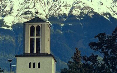
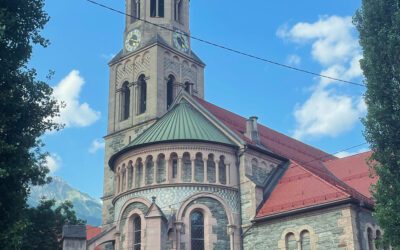
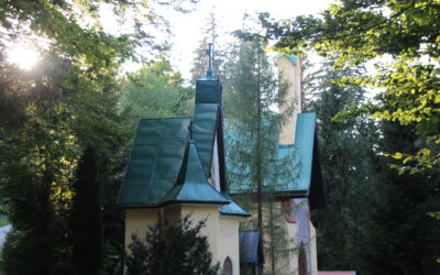
Guardian Angel Church
Gumppstrasse 67
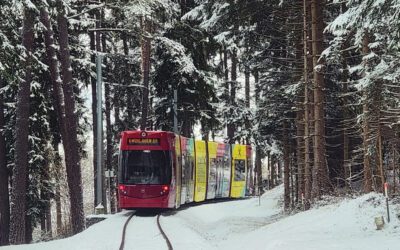
Tram line 6
Stops: Mühlau - Igls
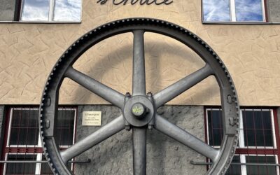
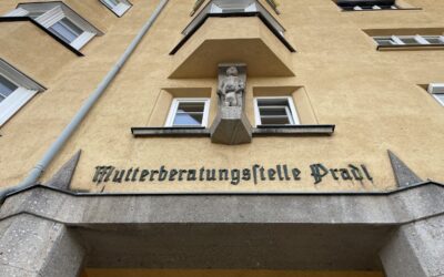
Racing school & kindergarten
Pembaurstraße 18 & 20
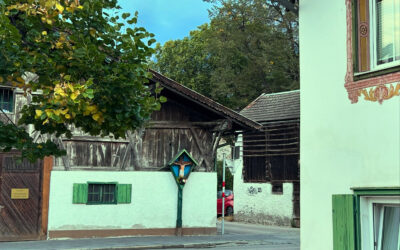
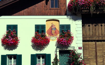
Farmhouses in Pradl
Pradlerstrasse / Egerdachstrasse
Rapoldi Park
Leipziger Platz
Tivoli
Sillufer / Pradl
Villa Epp
Hunoldstraße 10
Städtisches Hallenbad
Amraserstraße 3
Pradlerstraße
Pradlerstraße
Pembaurblock
Pembaurstraße 31 – 41
Philippine-Welser-Straße
Philippine-Welser-Straße
Militärfriedhof & Pradler Friedhof
Kaufmannstraße / Wiesengasse
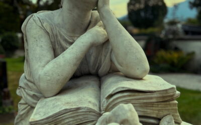
Alter Militärfriedhof Pradl
Anzengruberstraße
Tummelplatz
Haltestelle Tummelplatz
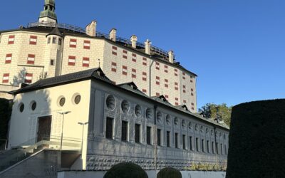
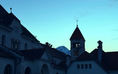
Schloss Ambras
Schloßstraße 12-20