City Center
Interesting facts about the city centre
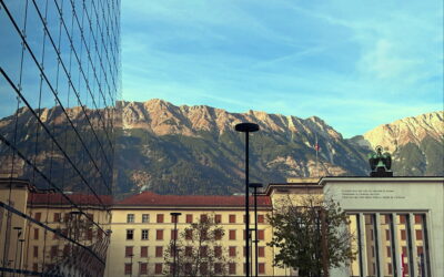
With Innsbruck becoming a city in the Middle Ages, space soon became tight. Not only did the cemetery around the small church of St. Jakob need to be expanded, but there was also a need for care for the sick and poor. These facilities, however, found neither room within the city walls nor favor among the citizens. In 1281, the city acquired the area of today’s Maria-Theresien-Straße from Wilten Abbey to create space in the so-called “New Town” for a hospital and a new cemetery. Soon, the first residential houses also appeared on the open land between Innsbruck and Wilten. What we now consider the city center was for centuries surrounded by farmland and the Inn River’s floodplain. On city views from between 1500 and 1900, one can observe how new streets and districts developed—first slowly, then rapidly. At today’s Triumphal Arch, Innsbruck soon bordered the municipality of Wilten, while the Sill River formed a natural boundary to the northeast. Between the 15th and the end of the 17th century, various regional rulers incorporated the wild area between the Congress House, Hofgarten, and Kettenbrücke into Innsbruck. Silbergasse, now Universitätsstraße, connected the city center with the industrial zone around the arsenal. The artificially constructed Sill Canal supplied businesses with urgently needed water for energy production. While Silbergasse housed businesses, workshops, and gradually founded monasteries, the area northeast of the city center in front of the Hofburg became the entertainment district for the aristocracy’s leisurely lifestyle, with theaters and the Hofgarten emerging there. South of the city walls, baroque palaces sprang up in the early modern period. Nobles, if they cared about status, had to maintain at least a secondary residence near the powerful. At the beginning of the 18th century, the Tyrolean Estates moved with their officials outside the city gates. The “New Town” became the “Nobility Lane.” In the 19th century, the so-called “moneyed aristocracy” joined in. Successful citizens took over the representative palaces of the nobility under new social rules and power structures, repurposing them for their own needs. Some baroque buildings still exist today, while others were rebuilt in the historicist style during the construction boom of the late 19th century. Maria-Theresien-Straße became Innsbruck’s commercial center and shopping district. At the corner of Anichstraße, the Zelger House was built. Only a few years after Bavaria occupied Tyrol, a fashion house opened there in 1817. The Zelger family would shape the city’s appearance in various ways for 200 years. Fashions came and went, but the business endured. In 1911, Josef Zelger had the five-story building constructed as a residential and commercial property based on Josef Retter’s plans. After World War II, his son Arthur Zelger took over—Arthur was the mastermind behind the legendary Tirol Werbung logo and many company logos still seen in the cityscape today. In 1857, Johann Peterlongo founded a weapons factory in the former Palais Sarnthein near the Triumphal Arch, which later became a hunting weapons store. Palais Lodron was home to perhaps Innsbruck’s most influential mayor, Wilhelm Greil. At the corner of Erlerstraße and Maria-Theresien-Straße stands a bright white residential building, built in 1910 to replace a 15th-century townhouse.
The eastern part of the city center developed differently. Beda Weber described the beginning of urban growth firsthand in 1851:
"... in the space between the Neustadt, the Franziskanergraben and the Universitätsgasse, a new city quarter is laid out, on the eastern side of which, on the other side of the small Sill on the meadows, called the Neuraut, the station for the Munich-Salzburg railway is located. The museum building in the street of the same name is located in this neighbourhood."
In 1839, the Innsbruck magistrate decided to address the growing housing shortage with apartment buildings in Neugasse am Angerzell, today’s Museumstraße. Beyond the existing continuous row of houses around Burggraben, not only new residential buildings but also the Ferdinandeum were built. In 1844, Bürgerstraße—today Wilhelm-Greil-Straße—branched off toward the New Square, now Boznerplatz, and was lined with houses. The biggest innovation was the railway station with its hotel-lined forecourt. In the west, from the 1860s onward, Müllerstraße, Heiliggeiststraße, Fallmerayerstraße, and Bürgerstraße were developed. With the opening of Anichstraße in 1877, all these settlements on formerly open fields were connected. Within a few decades, the once independent communities of Pradl in the east and Wilten in the south had merged with Innsbruck.
Throughout the 19th century, the entire city center expanded not only spatially. Department stores, theaters, cinemas, cafés, dance halls, and museums emerged as signs of general prosperity and growth. Many buildings were destroyed during World War II air raids. The gaps were partly filled with unattractive post-war constructions. The car-centered policies of the 1960s and 1970s also left their mark. The redesign of Maria-Theresien-Straße into a pedestrian zone took place in 2009 after long discussions dating back to the 1980s. With the renovation of Rathauspassage, the reopening of Kaufhaus Tyrol, and the redesign of Boznerplatz, pedestrians partially reclaimed Innsbruck’s city center. Innsbruck became “Innsbrooklyn.” Today, even the most energetic opponents of these changes would find it unthinkable to return to the old, traffic-heavy state—the old New Town has truly flourished.
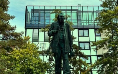
Adolf-Pichler-Platz
Adolf-Pichler-Platz
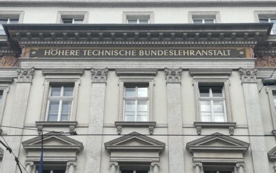
HTL Anichstraße
Anichstrasse 26 / 28
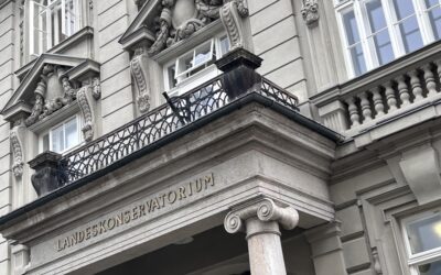
Tyrolean State Conservatory
Paul-Hofhaimer-Gasse 6
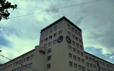
Power station & Casino
Salurnerstrasse 11 - 15
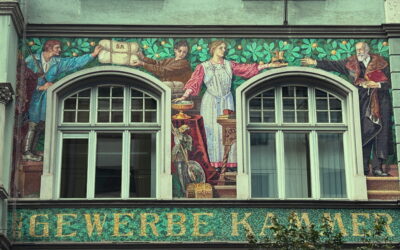
Chamber of Commerce
Meinhardstraße 12
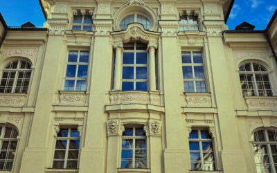
Palais Fugger-Taxis & Altes Landhaus
Maria-Theresienstrasse 45 / 43
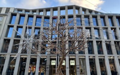
Tyrol department stores'
Maria-Theresienstrasse 31
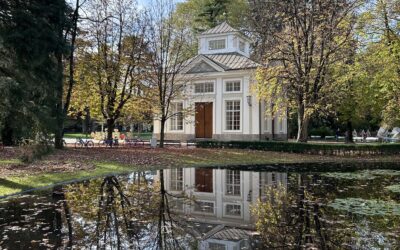
Hofgarten
Rennweg / Karl-Kapfererstraße
Landhausplatz & Tiroler Landhaus
Eduard Wallnöfer Square
Jesuit Church & Pfeifersberg Palace
Karl-Rahner-Platz / Sillgasse 6
Ferdinandeum
Museumstraße 15
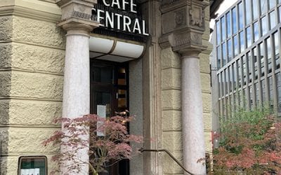
Cafe Central
Gilmstrasse 5
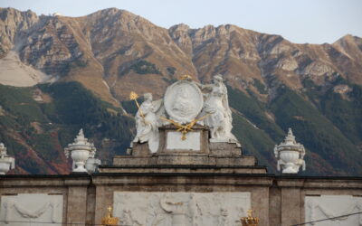
Triumphpforte
Maria-Theresienstrasse 46
Servitenkirche
Maria-Theresienstrasse 42
Hofkirche, Silberne Kapelle & Volkskunstmuseum
Universitätsstraße 2
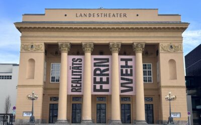
Tyrolean State Theatre & Congress Centre
Rennweg 3
Leopoldsbrunnen Innsbruck
University Road 1
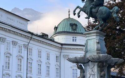
Hofburg
Rennweg 1
Annasäule
Maria-Theresienstrasse 31
Hospital church & old city hospital
Maria-Theresien-Strasse 2
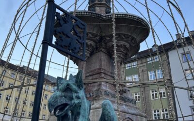
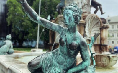
Rudolfsbrunnen & Boznerplatz
Boznerplatz